Headlights: now and here
Headlights are full of cutting-edge tools and watchers are electronics experts. The areas where conditions are most demanding are the ones that most need. Its history is the history of man's invention, and the present situation bears witness to the rebellion of the sea. Lighthouses are an aid to ships approaching the coast. But, in general, for those on earth, the operation is strange.
Headlights: now and here
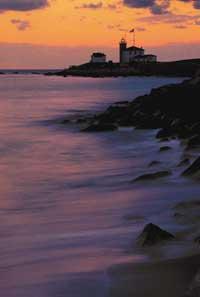
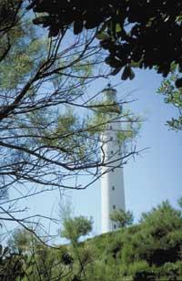
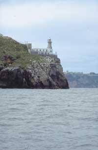
For sailors, headlights perform two functions: to help them know their exact position and indicate their location on land. During the night the lighthouse emits its information through lights and during the day the characteristics of the building itself allow it. There are no two headlights with identical buildings. Those on our coast are white to make a great contrast in the green mountains.
Therefore, in navigation maps it is very well defined how these characteristics look from the sea. The lighthouse of Zumaia, for example, is a white house with a white tower of three windows in the center. It has a blue line that separates the red roof from the wall of the house. The lighthouse lantern is also blue. All this is concretized in more detail than here in the navigation maps as measurements and appearances are indicated. In addition, sailors use drawings that show the appearance of the coast. They are very useful on the Basque coast, as it is very mountainous.
Dark emitters
One of the most important signs during the night is the lighthouse. Not only are they built to know if the boat is very close to the coast, but they also serve as reference points on a tour. Seen closely, the lights of the headlights do not seem stronger than those of neighboring villages. But these are reinforced by Fresnel lenses. Therefore, as we move away, the lights of the cities lose strength quickly, but those of the headlights disappear very slowly.
Today, as light of unlimited intensity can be emitted, one of the most important features is the height at which the lighthouse is built. The higher the light, the farther your signal will look.
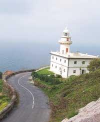
However, despite being at low altitude, headlights located in strategic places tend to have particularly strong lights. In Euskal Herria the most powerful are about 25 nautical miles (almost 50 kilometers). Among the most powerful are the lighthouse of Cape Higer, Igeldo in San Sebastian and Matxitxako.
To identify each lighthouse, a light ray code was invented. Once a luminaire is detected, sailors quantify the rays and measure the time; each lighthouse has its own ‘play of lights’, also defined in navigation maps. But this identification system is not exclusive to headlights, beacons and streetlights located in spikes also have light ray codes.
Some lighthouses emit groups of flashes. Other times the reverse system is used, such as that of Zumaia, in which the light is seen and occasionally that ray of light is momentarily covered and interrupted. There is a third type of luminaires and blackouts of equal duration (this type of light is called isofase), as the lighthouse of La Plata de Pasaia, with a period of four seconds.
Other signals
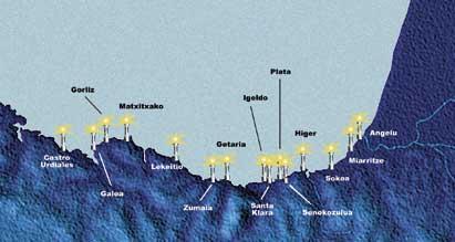
When there is fog the sea is calm. However, access to the port is often very complicated, since lighthouses are useless. Then, instead of emitting light, acoustic signals are launched. In order to hear these signals, motor vessels have to turn off the engine many times. However, it is an effective and now widely used system. For example, the lighthouse of Matxitxako, through Morse, broadcasts aloud the code of the letter M during cloudy days (regardless of time, the same signal is always broadcast by radio).
Beacons are used to report hazardous rock locations. When there is a deep sea, the boats walk by the wave. In these descents they can hit the underlying rocks and suck the helmet. Simply place a buoy with light to avoid them.
However, it is not the only function of small lights. These signals are found in all ports, both to mark the inlets (inlets, green lights in the port area and red ones in the starboard), and to determine the deepest path (alignment lights).
The difficulties to dock are evident in the river ports, on the one hand, by the arrival of a fluctuating current from the river and on the other, by the possible deterioration of the ship by logs and many other things. Therefore, it is very important to correctly mark the most appropriate access path. It is therefore not a complicated task for navigators to reach the port.
Packaging electronics
Are headlights needed today? Has not technology been developed enough to replace this need? Sailors say any help during a storm is good. The most striking tool today is GPS. This gives you your specific coordinates with a maximum incidence of 5 meters.
However, this machine does not offer solutions for all options and often presents problems. Among other things, sea water can cause short circuits that stop working in the worst moments.
Undoubtedly, technology facilitates navigation. But daily experience has shown that total control at sea is impossible.

