

Salt groundwater in Antarctica

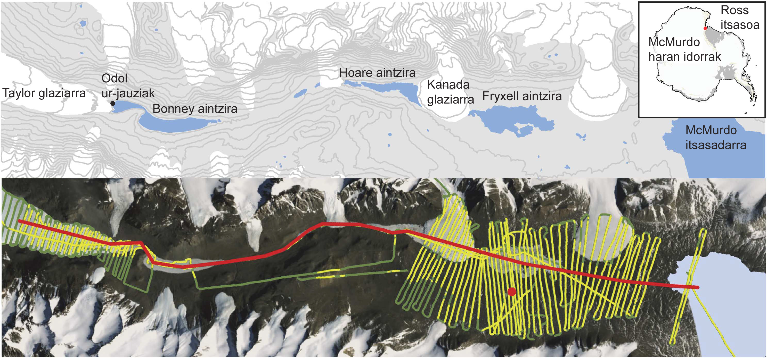
In one of the arid valleys of McMurdo, the Taylor Valley, two groundwater systems have been detected. The McMurdo network consists of a succession of iceless valleys along the Ross Sea of Antarctica. It is dominated by permafrost interspersed with glaciers and icy lagoons, especially on the surface. The research, led by a team of researchers from the University of Tennessee, has observed the subsoil and found that not everything is a harsh icy land. In particular, signs of aquatic systems under the permafrost have been detected, as salty as to contain liquids at local temperature.
This has measured the electrical resistivity of the soil (inverse to electrical conductivity) to a depth of about 350 meters, with a giant AEM sensor hung from a helicopter. The sensor generates electromagnetic currents in the subsoil and depending on its composition, the resistivity will have some values or others. Resistivity is an indicator of the humidity and temperature of the underground material. Thus, researchers have mapped almost entirely the Taylor Valley, 295 km2, from the helicopter, which has been done for the first time in Antarctica.
The results published in the journal Nature Communications have highlighted two salt water systems, according to the researchers.
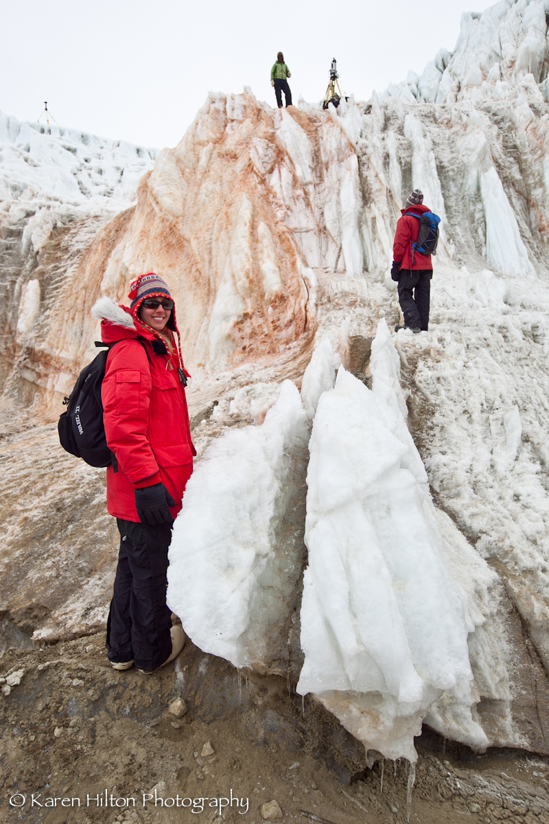
One at the inner end of the valley, under Taylor Glacier and Lake Bonney. On the border between the two are the Blood Jumps, an icy red salesal flow that flows from the front of the glacier to the lake. According to the researchers, this phenomenon is a “very striking test of the surface of groundwater”, and the resistivity data confirm the hypothesis.
The second water system is more coastal, 18 km from the coast, and is formed by the salt flats communicated with each other. Data indicate that two lakes supposedly separated by Canada's glacier would be connected underground and that the entire system would be poured into the McMurdo Strait.
Geological evidence suggests that the dry valleys of McMurdo were ancient fjords, and the current salt flats would be the marine waters of that time. The map constitutes the geological history of the area and allows to discover new ecosystems of living beings. In fact, active microorganisms have been found in the salt mines of the bark, among which are the Blood Leaps, and researchers believe that “the conditions of underground brine are compatible with the experience of microorganisms”.

Zu idazle
Zientzia aldizkaria

