

First-person chronicle of a rash
Numerous researchers from different disciplines have participated in the collection of data at the Old Summit or in the analysis of data sent from there in their laboratories, data that are still being studied. Janire Prudencio Dreamora, a PhD in Earth Sciences and a bullologist at the Institute of Geophysics of the University of Granada, is one of these researchers who says: “La Palma’s rash has allowed us to investigate a rash before and after.”
An announced rash
Prudencio has recalled that in the years 2017 and 2018 there were earthquakes in La Palma, but they remained, and at that time he was in the United States researching several volcanoes. Therefore, he did not pay particular attention to La Palma. In the summer of 2021, however, it became stronger, and then yes, they all stood by looking at La Palma.
Since early September, they were increasingly clear that a rash was going to occur, until a partner was told the day it was going to be. It didn't fail. The prediction was based on two types of data: deformation and seismicity.
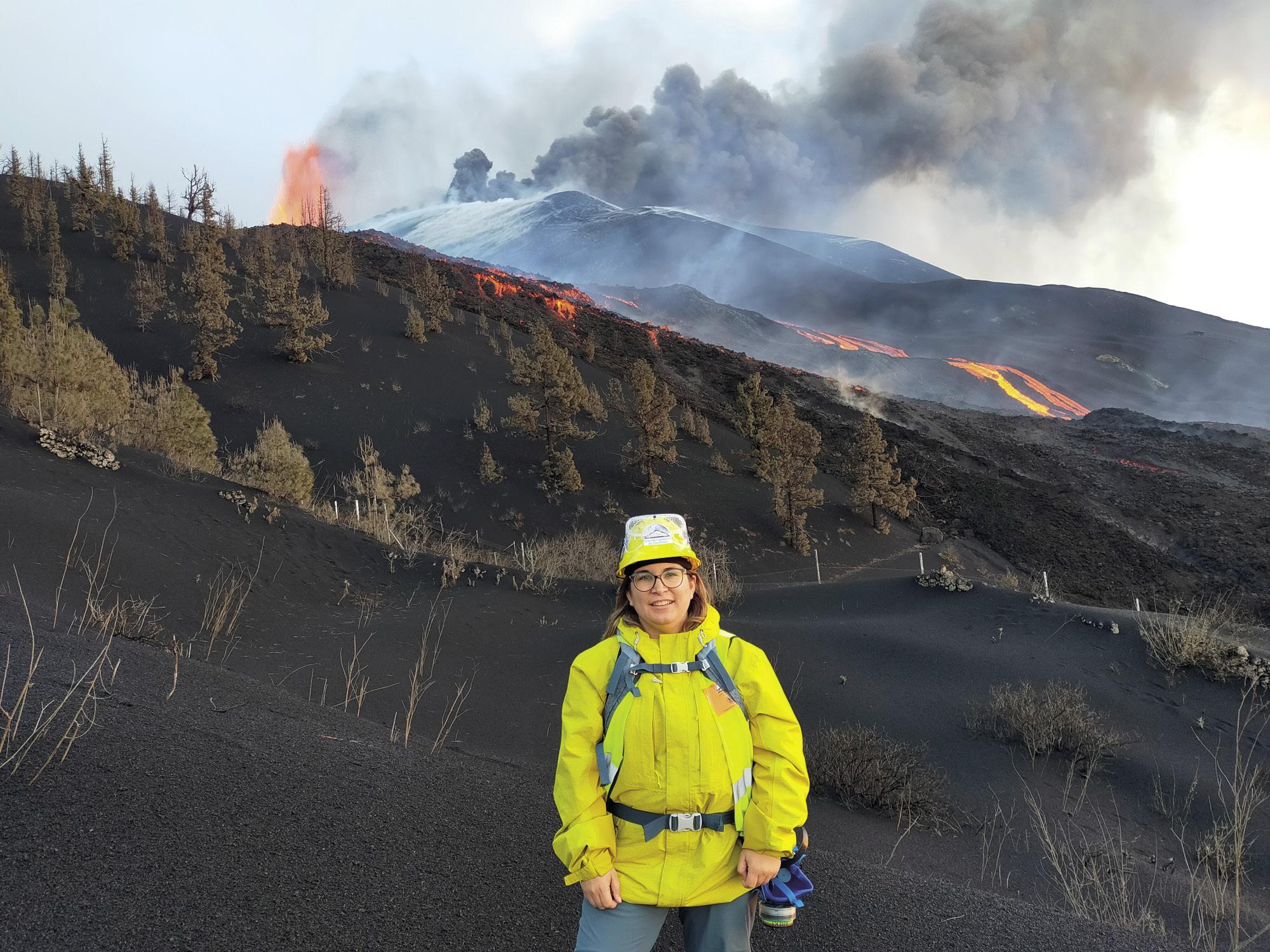
Prudencio said: “Every day the earth’s surface was more swollen. We could see it in satellite images, even in GPS signals. In fact, the Spanish Geographic Institute IGN and the Canary Islands Vulcanology Institute Get involved are tracking several points in La Palma, of which GPS data are available. In particular, the most significant data are the height and distance between two points: if you increase the height and distance, it means you are inflating.”
Swelling also indicates that the magma is close to the skin. And that is that when it's deep, even if it's active, its influence is not perceived on the surface of Earth. In contrast, when the surface approaches, it deforms.
Regarding seismicity, they observe its magnitude. Prudencio warns that volcanoes never measure magnitudes comparable to large earthquakes. “In both phenomena something is broken and as a consequence of this rupture, elastic waves are produced. But what breaks in volcanoes is smaller. The magnitude is, therefore, associated with the magnitude of the means that is broken; the increase in magnitude does not mean that there is less time to erupt, but that more material has been broken.”
On the contrary, this can be known by the arrangement of seismic waves: the lower the depth at which it occurs, the closer the eruption is. “In September, we saw that earthquakes were occurring at a depth of 10-15 cm, while the week before the eruption was increasingly superficial. Two days earlier, we measured at about zero kilometers. So we were pretty clear that the eruption was going to be immediate, but it could be all there and not explode the volcano. But in the end the magma came out.”
Multidisciplinary collaboration
Deformation and seismicity are the most significant characteristics to predict the eruption, but gases are also observed. And once the volcano erupts, researchers measure many other aspects: the composition of the magma, fluidity, etc., its effects on flora, fauna, air quality… “However, it must be said that all the data received during the eruption are destined for emergency management and no other analyses or studies are carried out until its completion. Now we are in it.”
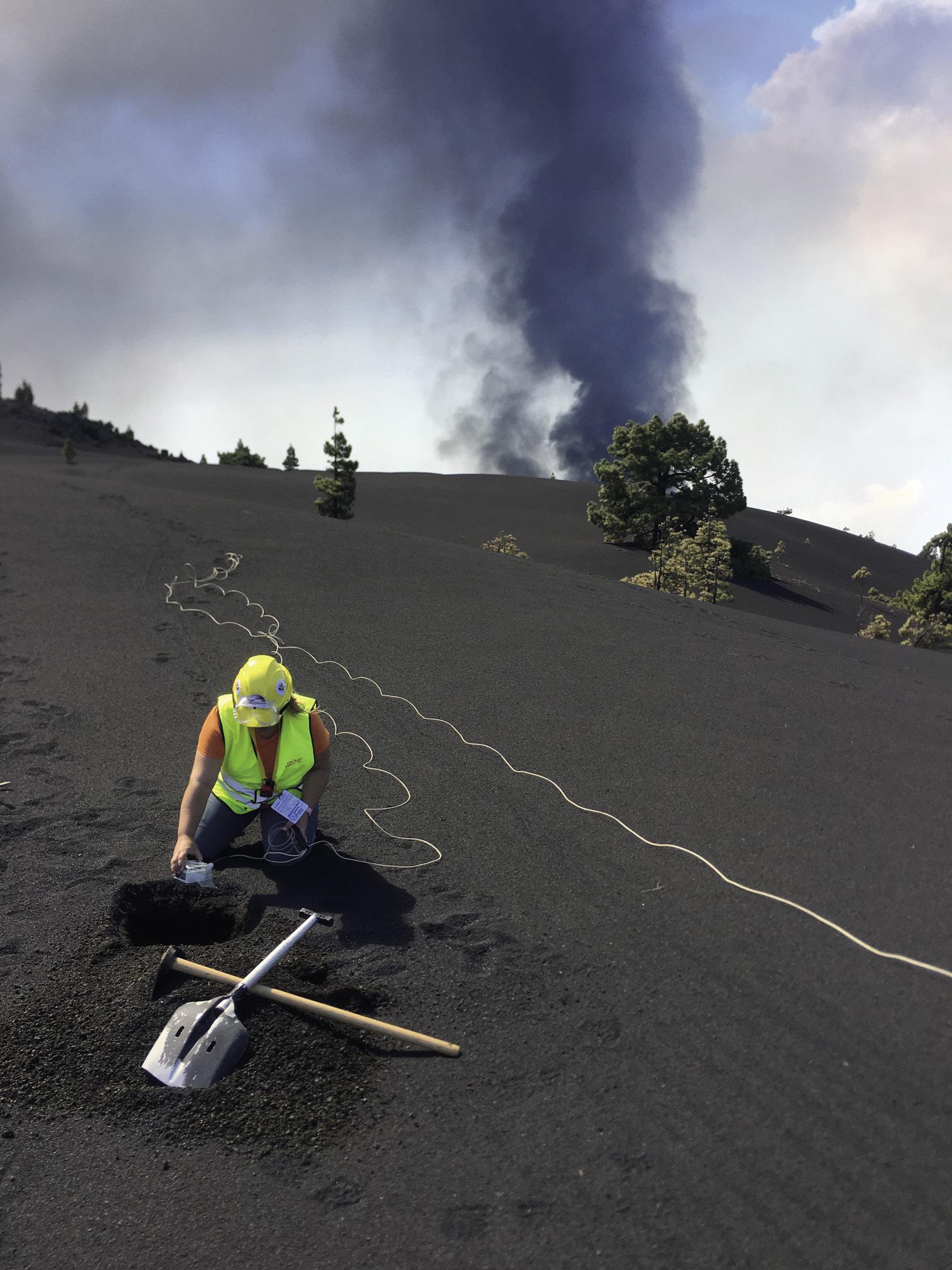
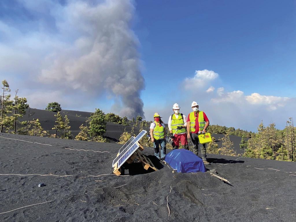
It is not easy to work during the rash because the risk of tool deterioration is high: “For example, at the beginning of the eruption, I went to install some seismometers. In Granada we collected their data through mobile data, but at one point the card broke and we stopped receiving the signal. These data were not useful for the crisis, but if they were, we would have to immediately resolve them. They are very common.”
Many researchers continue to study evolution. Prudencio and his colleagues now work on seismic tomography, which is his specialty: “It’s like medical CT (CT), but we do it to a volcano.”
Through this technique, they are able to clarify the internal structure of the 3D volcano. They've already finished this work and are now working on 4D, adding the dimension of time, as they've seen that the 3D structure is different before and after the eruption. “We took data from the earthquake from before and after the eruption, and from them we developed the tomography model.”
Foresee eruptions knowing volcanoes
In fact, the volcano of La Palma has been “a parenthesis” in his work: “We work on active volcanoes and, of course, in the Canary Islands we do not have an active volcano every day.” An explosion occurs every 25 minutes in Estronboli, Italy. However, it indicates that with the data collected in La Palma they have work for the years.
In total, he has researched about 20 volcanoes in his scientific career: In Italy, Etna, Estronboli and Vesuvius; in the Canary Islands, Iron, Tenerife and now in La Palma, it has performed tomography on three volcanoes; in Japan, on three volcanoes; in the United States, on three or four; in Antarctica, on the island of Deception; in Iceland, on two volcanoes is different and on the same mountain:
“It is not easy to predict where, when and how the next rash will be,” he has accepted. He explains that the seismic signals of volcanoes are of two types: some measure the movement of the earth, as in earthquakes, and others, that produced by the magma: “The magma is a moving fluid that we also detect and measure. And the signals of each volcano are always different from the others.”
The Prudencio team has two projects to anticipate eruptions, based on seismic signals. “We detect different parameters to signals and are studying which are useful for predicting all volcanoes. The point is that we have many parameters: energy, curosis, frequency -- in total 168. So we have work.”
Tonga Surprise
And the Tonga eruption has caught them working on it. According to Prudencio, it has been really rare: “This happens every 30-50 years. Since the Pinatubo eruption in 1991, there has been no such an energy eruption. Based on the volume of projected pyroclastic material and the height of the eruption column, the VEI scale (volcanic explosivity index, 0 to 8) has been valued at 5. They think the height of the spine reached 35 to 39 kilometers. These kinds of rashes show us the strength of our planet.”
He confesses that for him, that is, for those working on active volcanoes, it has been a surprise. The island had been suffering energy explosions for days that were altering the topography of the island. But nothing predicted the size of the rash that was going to occur.
“We need to continue to investigate the mechanism that caused the eruption column and the subsequent tsunami. We don't have all the data yet, but it's clear that the interaction between water and magma was related. In fact, this interaction produces what we call a freatomagmatic rash, and one of its most prominent features is that they are highly explosive. We have more doubts about the origin of the tsunami and about the “disappearance” of the island, as we do not know if there was a hip collapse that caused the eruption column and the tsunami, or the explosion was so energetic that the island disappeared and the tsunami,” he explains.
Therefore, there are still many questions to be answered and all recorded data will be very useful to clarify the details of the eruption.
Zu idazle
Zientzia aldizkaria

