Has our ria recovered?
The city of Bilbao and its territorial environment have always had a special relationship with its ria. Before industrialization, the estuary was a natural way of communication between the peoples. Later it became the means of transport of iron that represented the total economic development of the city. The estuary looked like an inexhaustible source of resources. But human beings, with little respect, gave him in exchange a little repair. Instead of protecting and caring for the environment that provided us with wealth, the only thing we did was to dirty it and destroy it, deploying there and here the surpluses generated on the path of the rich, without any control, leaving to the point of dying what always was a treasure for the vizcaínos.
Like a patient, the estuary suffered the consequences of excesses, such as the constant tremor of excessive concentrations of pollutants and the weakness of the pulse of life due to lack of oxygen. Fortunately, the diagnosis did not come too late and the treatment started had an expected influence on the patient, whose face gradually began to recover. Our patient, however, is still in the process of healing, improving its appearance day by day.
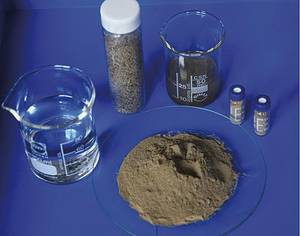
From the year 2005 to the year 2010, we have approached the patient punctually every three months, as the doctor collects the blood and urine, to take samples of water and sediments, measuring concentrations of metals and metaloids at trace level that cause such serious damage to health.
Prediction of the patient: height, weight and complexion
The Nervión estuary is located southeast of the Gulf of Bizkaia. The rivers Ibaizabal and Nerbioi join in Basauri and the cistern formed by this union becomes ria. Flood of other four streams: Cadagua and Galindo on the left, Asua and Gobela on the right.
The estuary pours its waters in the bay of Abra, 3.5 km wide and 30 m deep. The river basin of the estuary has an area of 1,700 km 2, with an average flow of 30 m 3 ·s -1 and an annual accumulation of sediments in the bottom of between 14.000 t and 1.000.000 t.

The affected population is one million inhabitants, 87% of the population of Bizkaia and 29% of the Basque Country. The Ria, as a whole, currently functions as a superport, supporting all the associated pressures.
Clinical history of the patient
XIV. In the eighteenth century, when Bilbao obtained the title of city, the usual livelihoods were agriculture and livestock on both sides of the estuary.
XIX. The true transformation of the city began in the twentieth century. Taking advantage that the mountains of the left bank of the estuary were rich in iron, Bilbao suffered a spectacular development due to the exploitation of the nearby mines. This contributed notably to the promotion of maritime trade and port activity, and the steel industry arose strongly. It can be said that at that time an industry based on mining, iron and shipyards was fully established in Bizkaia. In this development whirlpool, the Ría del Nervión-Ibaizabal became a communication route that will promote the development of Bilbao and the peoples of its surroundings.
In these golden years the health of the ria worsened notably. For the first time the patient underwent treatment: In 1900 a pioneering sanitation system was launched. The wastewater generated in the city, instead of being poured into the estuary, would be poured directly 15 km from Punta Galea through a pumping system. The medicinal herb was withdrawn to the ria, however, when construction works of the Deusto canal began. From there, the poison was redirected directly to the blood veins. Consequently, XX. In the second half of the twentieth century, the Bilbao estuary was among the most polluted in Europe.
In 1979, the General Sanitation Plan of the Bilbao Estuary was designed. Among the objectives of the project were to ensure the supply of water to the population, the recovery of life in all areas of the estuary and the significant reduction of industrial discharges. The debugger of Galindo, the most important in Bilbao, is the central axis of this project.
Medical recognition of the patient

However, the footprint of an industrial exploitation of many years of control has remained in the estuary. As in any other estuary, the sediments of the Nerbioi-Ibaizabal Estuary are witnesses of this time.
In fact, the final deposit of contaminants in the rías is a sediment of the lower and middle zone, where the pollutants poured over the years are accumulated. In the best of cases, contaminants are stored in the sediment forming stable chemical species. However, depending on the physico-chemical characteristics of the time in the estuary, or as a consequence of natural events (torrential rains) or not natural (industrial discharges, dredgings, etc. The accumulated pollutants can be mobilized, making them bioaccessible and a serious problem for human health. Hence the importance of monitoring the concentration of pollutants (and in particular of metals) in the sediments of the rías.
Taking into account all the above, our research team decided to analyze the evolution of metallic contamination in the Ría del Nervión-Ibaizabal, initiating for it in 2005 a surveillance monitoring session. Eight sampling points were selected. Four of them are located in the basin of the main tributaries (Cadagua, Asua, Galindo and Gobela), another at the mouth (Arriluze) and two others at the main riverbed, Casco Viejo and Zorroza. The last point, Udondo, is located on a semi-closed dock. In the eight points, every three months, we have collected water (surface and bottom, high and low tide) and surface sediment (0-2 cm). With the aim of knowing better the spatial evolution of pollution, two macrotasks have been carried out in 2009 and 2010, focusing the sediment on 49 points of the estuary.
Medical diagnosis
We have taken the pulse, measured the tension and checked for fever. The time has come to make a diagnosis of the general health condition of the patient.
Based on the results obtained, it can be safely affirmed that the historical contamination of the human source remains evident in the sediments, since the measured concentrations are significantly higher than the natural values defined for the area. In view of the spatial distribution of most metals, in addition, it can be affirmed that the historical contamination of sediments is local.
At present, the most toxic metals accumulate mainly in sediments near the rivers Gobela and Galindo and in various dársenas (Axpe, Udondo and Deusto). There are still areas with high levels of pollution, especially in the central part of the ria. The area between the tributary of Asua and the pier of Lamiako (along with the inner part of the channel of Deusto) and the outer area of the estuary (area of the bay of the Abra) has been identified as areas with higher levels of pollution.

Throughout the six years analyzed, an increase in the concentration of heavy metals in water is observed. This trend is more pronounced in the samples accumulated in pleamar and bottom, that is, in the waters that by effect of the tides penetrate through the mouth of the ria. It is possible, therefore, that some or some of the activities in the Abra area act as local sources of metals, dispersing the pollution in each pleamar through the estuary.
In this regard, there is another source of local pollution that could affect the metallic aquatic content: the sediment itself. It is observed that the metallic content of this compartment is decreasing over time, especially in the points of high metallic concentration (in the central part of the ria, that is, in the dock of Udondo, and in the tributaries of Gobela and Galindo). In the sediments collected at the low metallic points of the ria (at the lowest points of the ria), a tendency is observed to increase over time the concentrations of certain metals. Based on this, our research team suspects that metal contamination in sediments is being geographically redistributed. But, without completely discarding this theory, it is most likely that what sediments lose will accumulate in the water.
In addition to the pollution source mentioned so far (salt water from the bottom coming from the Abra and the sediment itself), other possible sources of contamination of the site have been identified. In spite of its outstanding contribution to all affluents, the most important with difference is that of the Galindo Valley, especially in terms of zinc and nickel (and probably cobalt). The results of the sediments collected at the point of Galindo also confirm that the Galindo treatment plant is a source of contamination.
In addition to local pollution, there are sources of contamination not specified in the estuary. It is a pollution that is distributed throughout the ria, with a similar effect on all points. It can have different origins. Among others: 1) dry or humid atmospheric sediment (consequence of metallic pollution released into the atmosphere by industries, etc.) and 2) urban spills, small masses of water that form in rainy seasons, both on roads and in the cities themselves. The measurements made in this paper do not allow calculating the amount of trace level elements that reach the estuary through indefinite sources, but it can be thought that their contribution is important, as indicated by the information available in the emission database to the atmosphere of the E-PRTR (European Pollutant Release and Transfer Register, http://prtr.ec.europa.eu/Home.aspx).
In general, it can be said that the Ría del Nervión-Ibaizabal, despite its still remarkable presence of chemical compounds of anthropogenic origin, has improved in terms of metallic contamination. In fact, many areas of the estuary have been recovered for recreational activities such as fishing or sport. However, we should not fall asleep and should continue treatment until our patient is fully cured. Future generations will thank us.


