

Equality of people on a map
Imagining the world on the plane is a problem for cartographers. Some characteristic must be sacrificed. In typical maps, for example, distances are saved. The map of Mercator, of 1569, is the clearest example, based above all on the cartography for navigation, very useful for the calculation of distances, but does not respect the surfaces: the countries near the poles proportionally a greater surface than the equatorial ones.
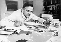
Mercator's projection is direct in itself, but if you want a more accurate view of the world is not enough, you need projections that take into account other characteristics to complement each other. Peters realized this problem, the need for other projections and realized a new world projection respecting the surfaces of the countries. Peters' screening was unveiled in 1974.
The Earth in two dimensions
At first glance, Peters' projection seems to be distorted, since, used to seeing projections like Mercator's, countries appear longer. But it is a projection made to capture the surfaces of countries and perfectly fulfills its function.

Examples include Africa and Siberia. Taking the map of Mercator, it does not seem that Siberia is much smaller than Africa. But let's remember that Siberia is near the North Pole, so its surface is larger than it is. And Africa, on the contrary, being in the south, represents less than it is.
In the projection of Peters highlights that Africa is much more territory than Siberia. As for the surfaces, Peters is more appropriate, since it took into account that Africa is 30.300.000 km 2 and Siberia 12.765.000 km 2. The extent of Siberia does not reach even half that of Africa.
Peters was concerned not only about the expansion of the countries, but also about their location. Because it is not the same to see your people on the map of the world in the center or in a corner, or up or down, above or below. In short, it did not consider it appropriate to use the same projection in almost all the countries of the world, especially because the most populated countries appeared undervalued in those maps.
By convention, the north is placed above, centering the Atlantic Ocean, and consequently Europe appears in the center of the map in a privileged position.

Arno Peters opposed these conventions, claiming that meridian 0 needed in front of the Bering Strait instead of Greenwich. This claim seems reasonable, since to reconcile the time the length of Bering is used internationally.
Synoptic view of history
Peters studied history at the University of Berlin and worked for three decades in the synchronous history of the world. At that time, synchronous history was a new stream of historical researchers. It is a question of explaining in every moment of history the situation of several peoples, guaranteeing as much as possible that all peoples have the same presence.
Synchronous history is far from the usual history lessons, for example, it is not considered necessary to learn dates and years. In fact, knowing the situation of different peoples of the world in each historical period, a more global concept of history is achieved.
His most important work outside cartography was Synchronoptiche Weltgeschichte (Synchronous History of the World), published in Germany in 1952. From the 3000 years, he dedicated to every century of history the same space in that book, not to give less importance to some epochs than to others.
He sought equality among peoples and for this he incited the eyes of those accustomed to conventions. What he said and thought about history and cartography, and the music he liked so much. Each of the notes of the staff was given a color and the scores are dressed in colors. But in this field, conventions were also imposed and the idea did not advance. However, this did not reduce his fondness for music and brought anywhere the accordion he loved so much when he went.
Zu idazle
Zientzia aldizkaria

