

Drones from the battlefield to the classroom
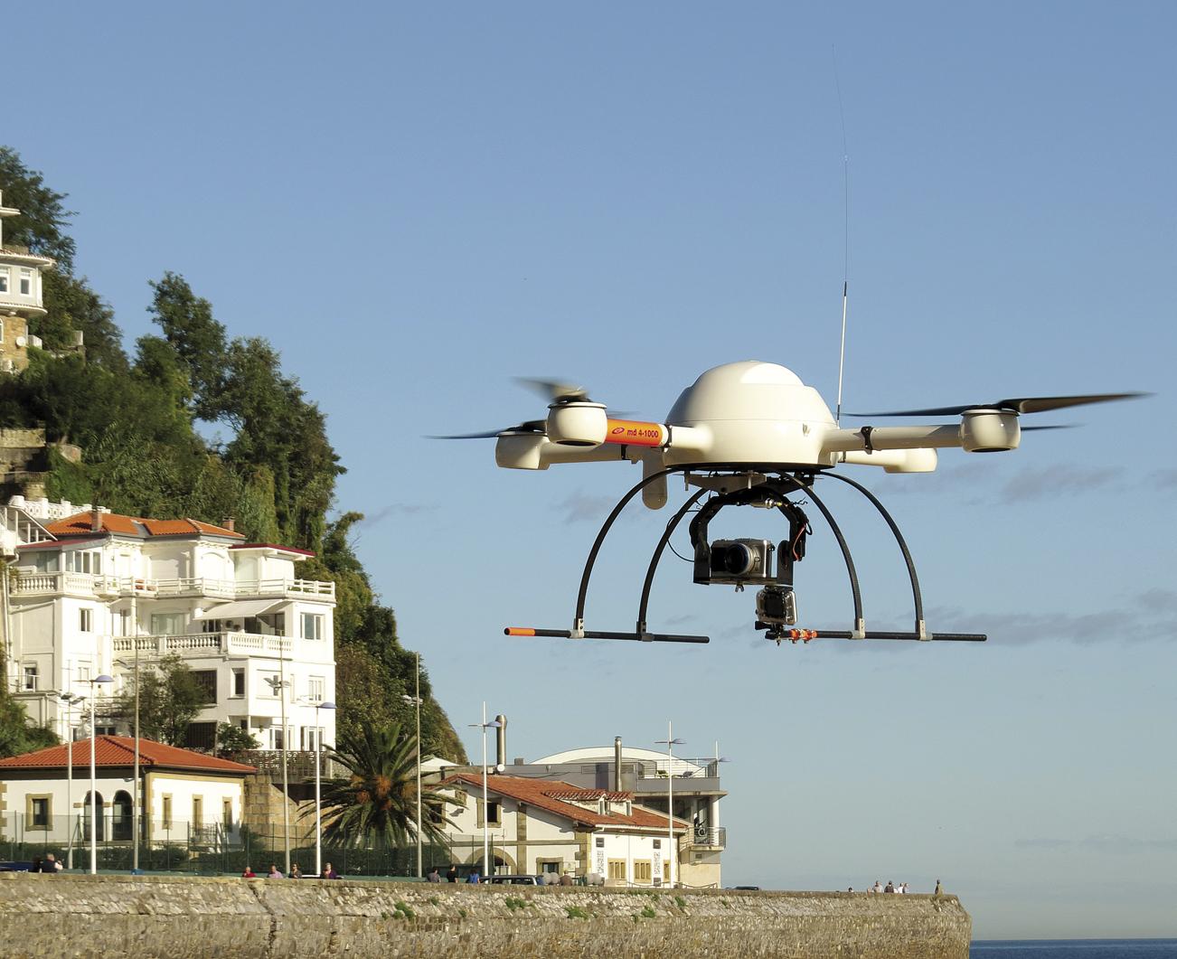
In the civil work cycle of the Professional Training of Bidasoa-Irun a drone was acquired three years ago and since then it is working with a flying device. "We use the drone to carry out photogrammetry work through photographs -- by Dani Tenarena, one of the teachers of the cycle. We seek to obtain three-dimensional information from Earth to produce maps that reflect the planimetry and altimetry of the land. Of the earth or of an object. In fact, in speaking of photogrammetry, I can reflect in the same way Mount Jaizkibel or, for example, the church of Hondarribia. In the end it is an object that I can imagine."
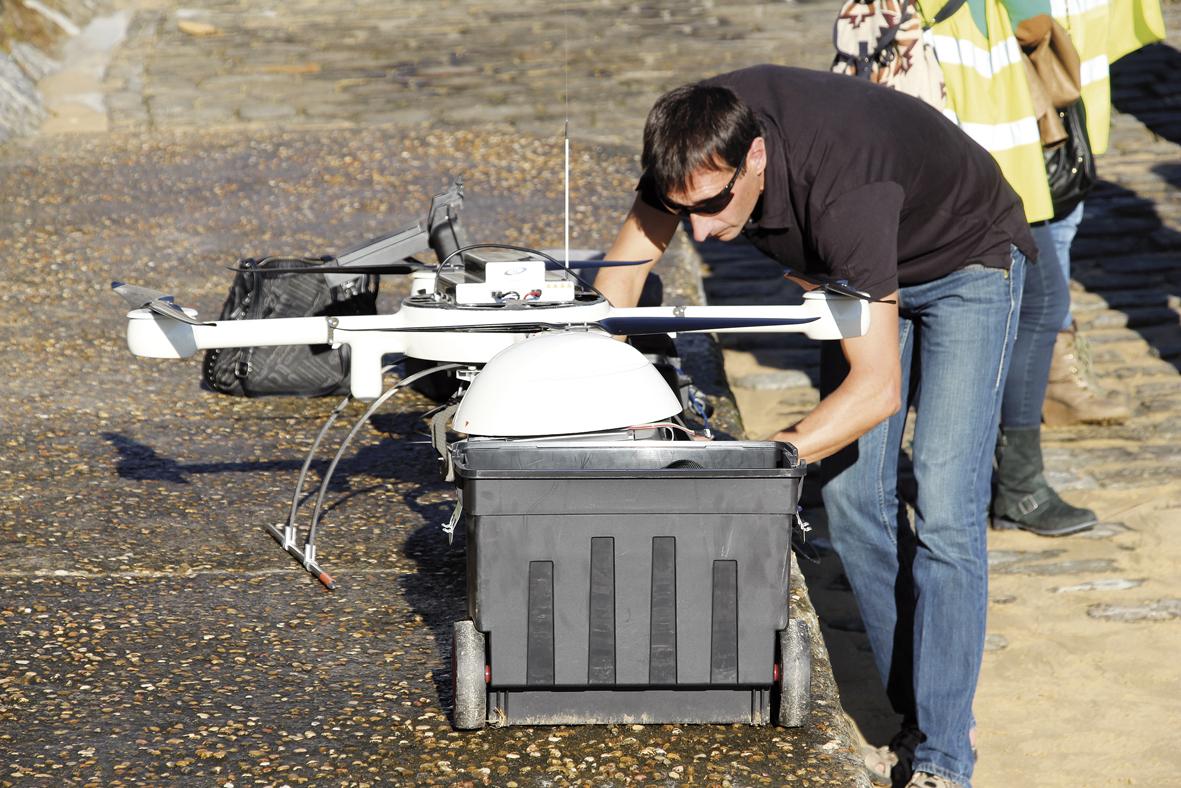
For purely aesthetic or entertainment purposes, the drone can be manually driven by a joystic and with the device in sight. However, for other technical works, they are conducted in a scheduled way. In the computer the programming of the flight is carried out, some points are specified to travel, waypoints and is indicated what to do in those points.
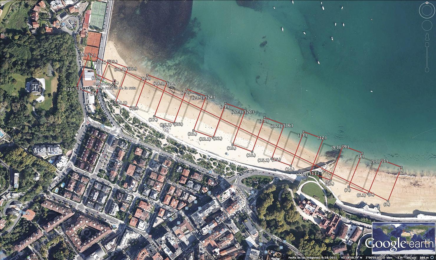
For the realization of photogrammetry works, for example, the drone makes photographs of the earth in an aligned way according to the objective that is wanted to look for and the path that has been given to it. Each of the photographs is superimposed to the next one, covering 60-70% of the previous one in length and 30-40% in width.
Through several equations it is possible to know at what time each of the photos has been taken and where the camera was at the time of its exit. With this information, the position of all surface objects is determined. "When we prepare the flight, we say to the drone, fly over the beach and take photos overlapping 70% and 40%. When we schedule it like this, it is the software itself that decides the number of photographs and positions it must perform to meet the requirements we have marked. The result is a point cloud."
According to Dani Tena, during the cycle, students must acquire the ability to learn to program a software that flies the drone. "Not only that, but they must also learn how to schedule the flight and then, once the device has landed, learn how to get photos, use photogrammetry software and make three-dimensional maps."
Substitute of the topography
Photogrammetry with drones is considered to be the heir of classical topography in school, especially from a temporary and cost point of view. "When you are going to perform the sampling of the earth, the surveyor should take point-to-point data. To get between 3,000 and 5,000 points, a surveyor can spend a week working with classic methods. We fly one morning or one afternoon, bring the data to the computer and in 20 minutes generate 1,000,000 points. Perhaps the quality of our points is not so good, but the quantity represents this lack."
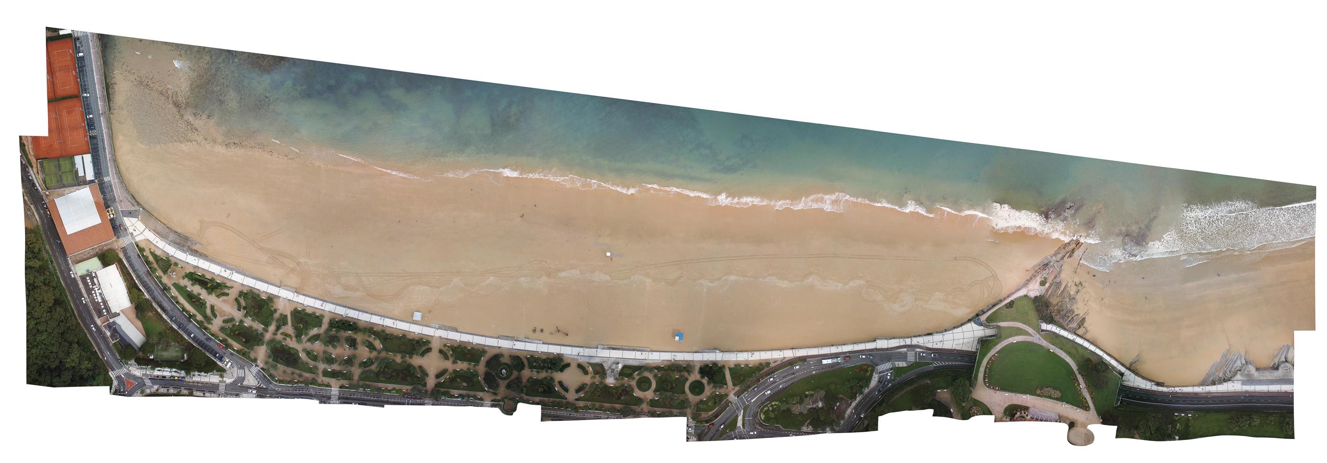
In the planes that are generated with the images obtained by the drones appears all that is in surface: ramps, shrubs, fences, stairs, banks... And these models also obtain orthophotos, that is, representations through photographs of the terrestrial surface, with all the elements that appear on the same scale, without errors of perspective. In the orthophotos, therefore, precise measurements can be made, as well as in the usual planes used in cartography. "It is the future. Topography and mapping have evolved over time, have passed several phases, and this is one more. It would not make sense to teach students to use the tools used 10 years ago," says Tena.
For the drone-photogrammetry pair, new applications are foreseen: building modeling, restoration, archaeological excavation as many times as you want, quarries, control of electrical installations, etc. The work of the drone will depend on the sensor put on it. "The flying device has its importance, but the device is not the most important, but the sensor that will be applied to it. If I put the normal camera, it will make normal photos, the drone will do the work according to what we will apply with the video camera, with a weapon… As Professional Training our goal is not to fly the devices. The important thing is that the student knows what type of sensors can place in the drone and what can do with this information."

When the drone stepped on the sand of Ondarreta is noon and the exercise is over. The battery does not give it for much more, about an hour of travel. Enough time to collect the data, return to the center and perform the ortofoto of the beach with the information received.
Different types of drones
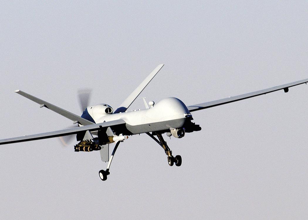
The uses of drones can be, therefore, very varied, and the use itself frequently conditions the design of the same. They are classified according to the weight and type of south. "Those of less than five kilos, like ours, enter the category of microphones; from there, up to 200 kilos, are considered of average category and more than 200 kilos as big. Ratings are also made according to your restraint plane to get flying. Taking into account this, two types of drones are distinguished mainly: those of rotating wings and those of fixed wings. The presses can have two wings, four, six, eight or more; the fixed ones are like planes, with a propeller that allows the propulsion of the device and wings that ensure the containment plane".
The Bidasoa-Irun Professional Training Drone is electric and works with batteries. Larger drones also use another fuel, liquid fuels like planes, and have a great autonomy to fly, both in time and in kilometers. They can travel thousands of kilometers.
Both of one type and another, the drones move in a situation of allegality, since there is still no clear regulation. It is about starting the development of a regulation at European level, but so far they can be used freely in an uncontrolled airspace. That is to say, they cannot be used in the areas where commercial planes move -- in the vicinity of the airports -- they cannot exceed 300 meters of height, nor the flights on large crowds are forbidden, but the rest has no limits. "In the United States they are more advanced from the normative point of view, and by 2015 large drones and commercial airplanes are expected to share airspace." That is, there are new colonizers.
Zu idazle
Zientzia aldizkaria

