Basque Coast (II): Marshes of Gipuzkoa
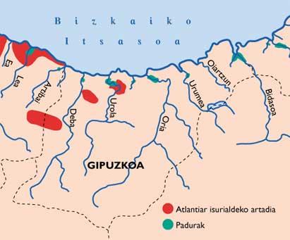
Marshes of Gipuzkoa
Our readers will remember that last month we opened a series of articles to analyze the situation of the Basque coast. In this first article, after an exhaustive description of the marine marshes, the situation of these ecosystems in the Lapurdi rías was analyzed. On this occasion, we will go to the Gipuzkoan territory to know its marshes.
The territory of Gipuzkoa is formed by numerous rivers of short length that arise in the dividing between the Mediterranean and Atlantic slopes. As you know, at the end of each of them, until recently there were precious marshes.
At present, due to the great industrial development that has experienced this territory, numerous river valleys and most of its mouth are subjected to strong human pressures, reducing the marshes of Gipuzkoa to a minimum.
But let us look more specifically at this situation.
Txingudi
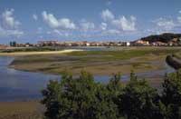
It is the name by which is known the bay that the river Bidasoa creates when it joins the sea after being born in Navarra and travel its last kilometers between Lapurdi and Gipuzkoa.
In this bay, although it is not possible to compare it with the one that existed decades ago, large extensions of marsh have remained. However, it should be noted that the enormous human pressure and the large extensions of the three municipalities of the area (Irun, Hendaia and Hondarribia) have divided the marsh into four sections difficult to join (Bidasoa Island, Plaiaundi, Belenia and Jaizubia), which also suffer strong attacks such as dredgings, fillings, canalizations, water pollution, poaching, etc.
Despite the unfortunate situation of Txingudi, from the ornithological point of view, various international institutions have recognized it as an environment of great importance, due to its strategic situation (at the western end of the Pyrenees), especially during migration, which constitutes a step and a stop of hundreds of bird species.
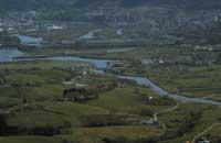
It should be noted that the only population of the toad corridor of Gipuzkoa (Bufo calamita) and the most important of the Basque coast appears in Txingudi. Special mention deserves the presence of the halophyte plants Cochenaria pyrenaica aestuarina, of striking white flower that can be seen in this marsh, for not appearing in other marshes of Euskal Herria.
As for its legal situation, it must be said that although in the last 14 years it has had several protection and recovery projects, the only support it has achieved to date is the hunting reserve. However, in 1991, as a result of the agreement signed between the municipalities of Irun and Hondarribia, the Provincial Council of Gipuzkoa and the Basque Government, this year the Basque Parliament has provisionally approved the special plan for the protection and recovery of Txingudi Bay, opening a small window of hope for this important wetland.
Pasaia Cove
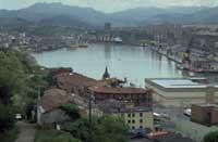
The Oiartzun River, just 19 kilometers east of Gipuzkoa, has great importance in its mouth to form the cove of Pasaia that constitutes the main fishing port of Gipuzkoa. This has been the reason for the disappearance of the great and wonderful marsh that opened around this cove, occupying the territories occupied by the peoples of Pasaia and Errenteria and the facilities of the Port.
It is noteworthy the project of sport dock collected in the project of harbour planning recently launched by the harbour authorities of Pasaia. It is one of the best approaches in the Basque Country, since instead of destroying an environment of great ecological importance, it proposes to install it in a totally degraded area, which in turn would significantly improve its appearance.
Urumea
The Urumea River, born in Navarre, enters Hernani in Gipuzkoa and flows along the famous bay of La Concha, passing its last kilometers channeled through the streets of San Sebastian.
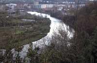
Indeed. The impressive expansion of the capital of Gipuzkoa in the last century has left some of the most beautiful wetlands in Euskal Herria under the asphalt. Just take a look at the old engravings to show that all of San Sebastian is built on marshes, sand and dunes of the Urumea and Ibaeta rivers.
The last remains of this wonderful marsh are a few square meters that have remained on both banks of the river still unchanneled. However, the recent General Plan of San Sebastian proposes the destruction of these last vestiges, since it proposes the channeling of the river to Loiola.
Oria
This river, the longest in Gipuzkoa, is born in the Sierra de Aizkorri and crosses, along its 65 kilometers, one of the most industrialized regions of the province, with the consequent quality of its waters and the painful situation of its margins.
Surprisingly, this river, totally degraded in the upper and middle part, in its final stretch, next to the smoothing of the slope, has magnificent meanders of great natural and landscape value, opening a little lower the estuary that has best maintained the natural structure in Gipuzkoa.
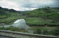
This estuary, which, like the rest, has suffered numerous canalizations, dredgings and desiccations, still preserves wonderful marsh enclaves (Portuetxe, Oribar, Txanka behekoa,...) and areas that have recovered the characteristics of non-halafite wetlands (Motondo,...) due to the loss of influence of tides.
In the latter, precisely, we can find the most important representation of the rich herpetofauna of the estuary, artificial wetlands that offered numerous ecological niches colonized by different species of reptiles and amphibians. If to this we add that, due to its climatic conditions, reptiles and amphibians appear both Atlantic and Mediterranean and that there is only one population of Hyla meridionalis in the CAPV, the herpetofauna is undoubtedly the singularity of the ria of the Oria.
Analyzing the situation of the Ria del Oria and knowing the painful situation of most of the rías of the Basque Country, more than one will think that this ria will be already protected. Well, no! The Deputy Minister of Environment of the Basque Government, despite the elaboration of a Special Plan for the Protection and Recovery of Wetlands of the Oria and the intention of the Right of Spatial Planning (DOT) to protect these spaces under an active conservation figure, is suffering serious attacks and threats, especially by the City of Orio, whose urban and industrial expansion pursues some of these valuable aspects.
Arroyo Inurritza
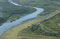
This short stream that flows east of Zarautz beach would probably go unnoticed if the situation of the rest of the Basque Country rías were optimal. But the most unfortunate situation, along with the small marshes and dunes that have kept this stream at its mouth, have made it an environment to consider in this study.
Apparently, through the agreement reached by MOPTMA, the City of Zarautz and the Izadi Group of Zarautz, this valuable aspect will be supported and recovered in part, having again demonstrated that sitting down and talking quietly is the best way to reach an agreement between different interests.
Urola
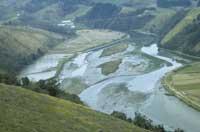
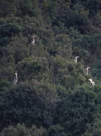
After 55 kilometers of the Aizkorri mountain range, the Urola river flows into Zumaia, forming one of the most beautiful seas in the Basque Country. In this estuary has remained a couple of areas of marsh of great extension: Bedua and Xantixo, in both cases, in addition to important representations of the halophyte vegetation of this ecosystem, especially during migration, in which it is normal to observe numerous species of different birds. As an example, it is worth mentioning that in Bedua we can find the largest wintering population of the royal heron of Gipuzkoa (Ardea cinerea), without forgetting the high concentrations of species of birds of limícolas that can sometimes be seen in the limícolas of these marshes.
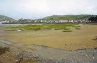
In addition, the holm oak, recognized as a tertiary relic and that constitutes the climate forest of the coast of the Basque Country to the west of Zumaia, surrounds the entire marsh of Bedua, making this area the main ecological jewel of Gipuzkoa.
Unfortunately, in recent years the fever of the sports docks that are heating the coast of Euskal Herria has turned their eyes on this estuary, the marsh of Xantixo. So far it has been useless for the Department of Urbanism, Housing and Environment to approve and extol the ecological values of this aspect, incorporate them into the “Catalogue of Natural Enclaves of the Basque Country” or declare it Part of Strict Conservation within the Rights of Spatial Planning (DOT), which continues with the project of its marina. If this beautiful marsh were covered by a marina, it would cause a great loss to our ecological heritage.
Deba
To the west, Deba is the last river of Gipuzkoa. Since its birth, on Mount Arlaban, it has endured strong human and industrial pressures, being its waters one of the highest in Europe.
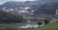
The main characteristic of its estuary is the narrowing of the surrounding mountains. Therefore, his schism has never been too wide without fear.
However, today, the largest area that would occupy this ancient marsh has been occupied by the people of Deba. The rest, except for two small pieces, have been dried for agricultural use.
According to environmentalists, protecting and recovering as much as possible these small aspects means conserving an important part of the ecological heritage of the people of Deba. However, the political leaders of the people and the Provincial Council of Gipuzkoa do not think the same thing, since if the project they just took out to organize the estuary went ahead, these small marshes would disappear forever.

