2013/11/01
302. zenbakia

eu es fr en cat gl
Aparecerá un contenido traducido automáticamente. ¿Deseas continuar?
Un contenu traduit automatiquement apparaîtra. Voulez-vous continuer?
An automatically translated content item will be displayed. Do you want to continue?
Apareixerà un contingut traduït automàticament. Vols continuar?
Aparecerá un contido traducido automaticamente. ¿Desexas continuar?
Recognition of the wonders
Text created by automatic translator Elia and has not been subsequently revised by translators.
Elia Elhuyar
Ed. Asier Hilario
"The history of the Earth is written on rocks. If a chapter were lost, a part of history would be lost forever." The words of geologist Miren Mendia point to the need to know and protect the geological heritage, and precisely to respond to this need they have elaborated the Inventory of Points of Geological Interest of the Basque Country.
According to Professor Mendia, "because we want what we know", one of the objectives of the inventory has been to obtain knowledge of heritage. However, it has not been the only intention. In addition to being a tool to disseminate knowledge, administrations can make decisions and the authors hope it is a useful tool to promote ecotourism.
The inventory has been the result of the work of a large group of experts. The team led by the professor of the University of the Basque Country, Miren Mendia, in collaboration with Asier Hilario, has been constituted by twenty people who have elaborated a systematic inventory with the aim of identifying, describing and valuing the geological heritage of the Autonomous Community of the Basque Country.
The history of the Inventory of Geological Areas of the Basque Country was the pilot project launched at the Urdaibai Biosphere Reserve. The work carried out in Urdaibai allowed to elaborate the methodology and to fix the valuation parameters. According to this methodology, the main criteria for the elaboration of the inventory have been the intrinsic value of the centers of interest, the capacity of dissemination and the capacity of tourist use.
Professor Mendia explained that there are several variables to be taken into account when evaluating the points of interest: "One of them is abundance or scarcity. That is, it must be taken into account whether a particular outcrop is rare in a certain geological medium, or if it is very widespread. In addition, we must know if it is representative of a geological context, that is, of the processes that have occurred in the past." Likewise, the assessment of points of interest will depend on its scientific relevance, taking into account whether it is mentioned in the scientific journals of the area, that is, if it is internationally known. One of these spaces of special international relevance is the stratotype of the beach of Gorrondatxe. In fact, the strata located on the cliff of the beach of Gorrondatxe, on the coast of Vizcaíno, are a world reference of the lutetic era by decision of the International Union of Geological Sciences.
Taking into account the variables marked by the methodology, the result of the first selection of experts was the identification of 300 sites, which after taking into account the assessment criteria selected 150. The inventory was carried out at the request of the Department of Environment and Territorial Policy of the Basque Government, requesting a document to collect 150 points of interest.
The record of each of the points of interest designated by the inventory has been completed. To the detailed description of each site, the authors have added an assessment based on the criteria considered, as well as a detailed mapping. Now, with the aim of publicizing the Inventory of Geological Interest Centers of the Autonomous Community of the Basque Country and deciding the steps that can be taken in the future, the Basque Government plans to launch a process of participation aimed at administrations, associations and citizenship.
Beyond the collection of points of interest, the authors hope that it contributes to the dissemination of knowledge of geology. The document will fill an important gap in this sense as geological ignorance is evident. "Normally people have no problems separating two trees, but few know how to differentiate two stones," said Professor Mendia. "We have no awareness of the issues that the Earth gives us. Energy sources, raw materials... All this is geodiversity and the history of humanity is closely linked to the evolution of these resources."
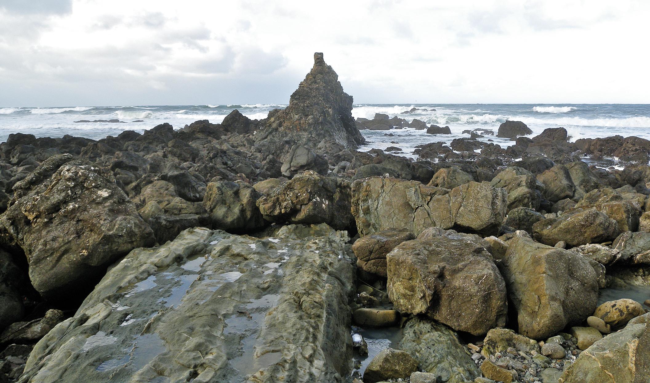
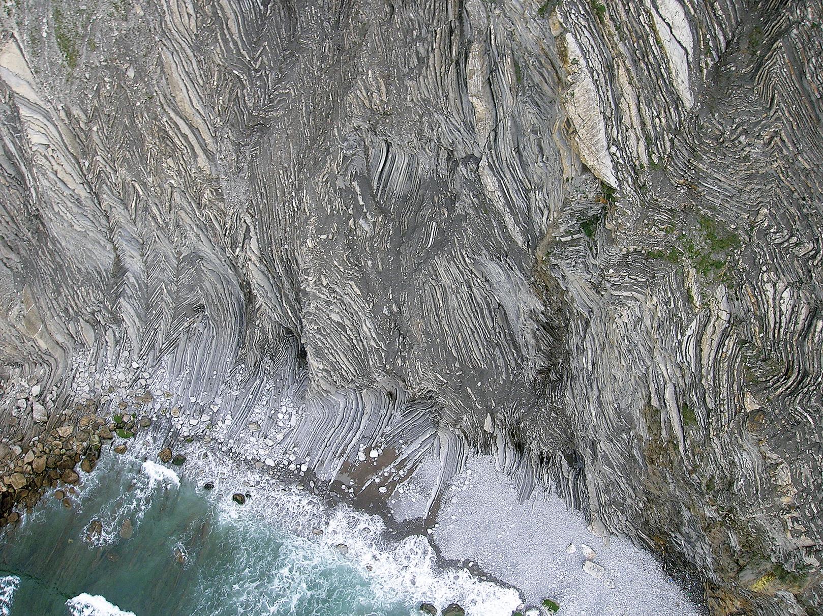
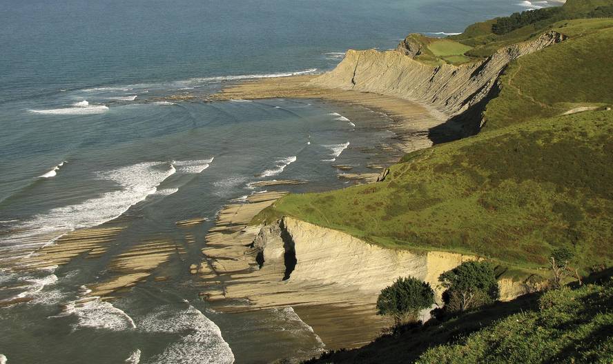
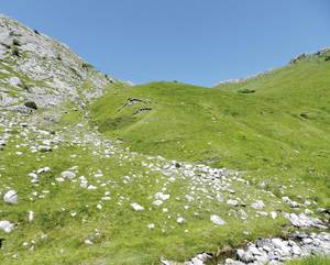
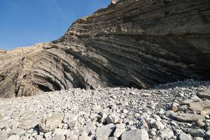
Intertidal rasa of depths
The intertidal rasa of depths presents a great geomorphological interest. Due to the differential erosion of flysch, the coastal geometry is irregular, intercaling coves (marl) and cabos (limestone and sandstone).
Coastal erosive agents produce no variations at the same rate in all geological strata of the cliffs. The erosion of some materials is easier, so when a faster delay occurs on the coast bays, rías and geomorphological elements of this type are generated. Other materials are difficult to erode by erosive agents, so islands, cabos and geomorphological elements of this type appear. Sakoneta and Mendata coves are an example of understanding the process of differential erosion.
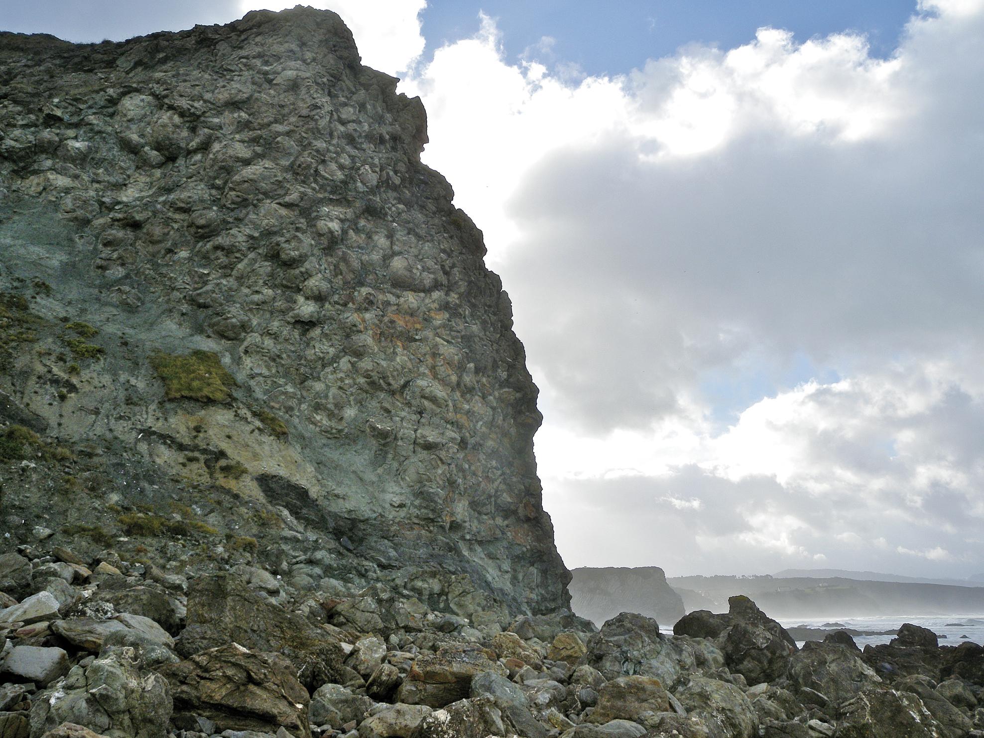
Pillow-lavas de Meñakoz
The furnaces that appear at the western end of the beach of Meñakoz constitute one of the most representative flows of the vulcanism of the Upper Cretaceous of the Vasco-Cantabrian Basin. This spectacular quilt of padded lava (pillow-lava) is the one that makes it stand out.
Ed. Look at Mendia
The piled lavas are called in the form of large pised spheres. These forms give rise to underwater volcanic eruptions and those of Meñakoz are excellent samples of the general characteristics of the submarine furnaces.

Ed. Look at Mendia
From a lava wash with columnar disjunction to large pilows (mega-pillows), to a complete and continuous transformation that leads to the pillow-pil furnaces, you can see in Meñakoz a magnificent association of volcanic fazie. This transformation is visible in very few places in the world, together these three fazie. One of them is Meñakoz.
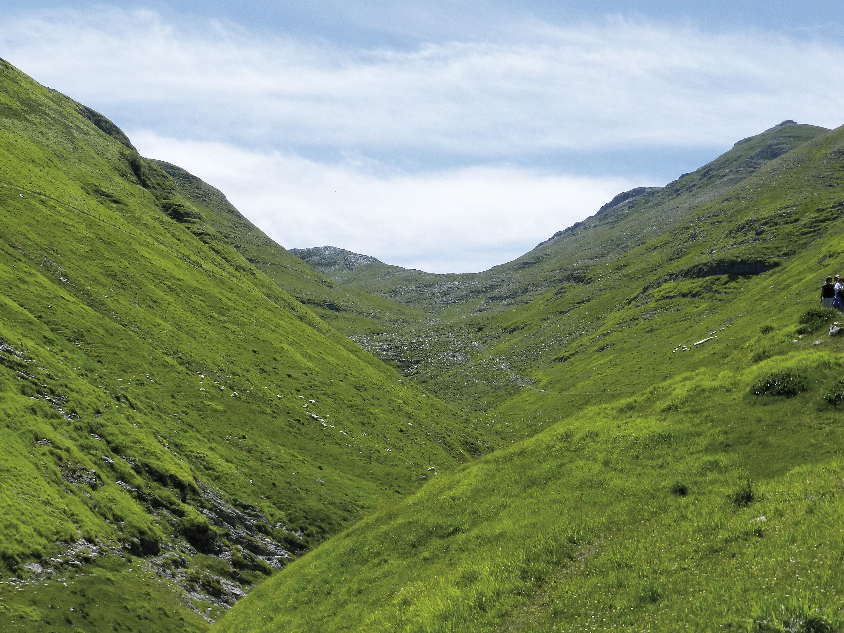
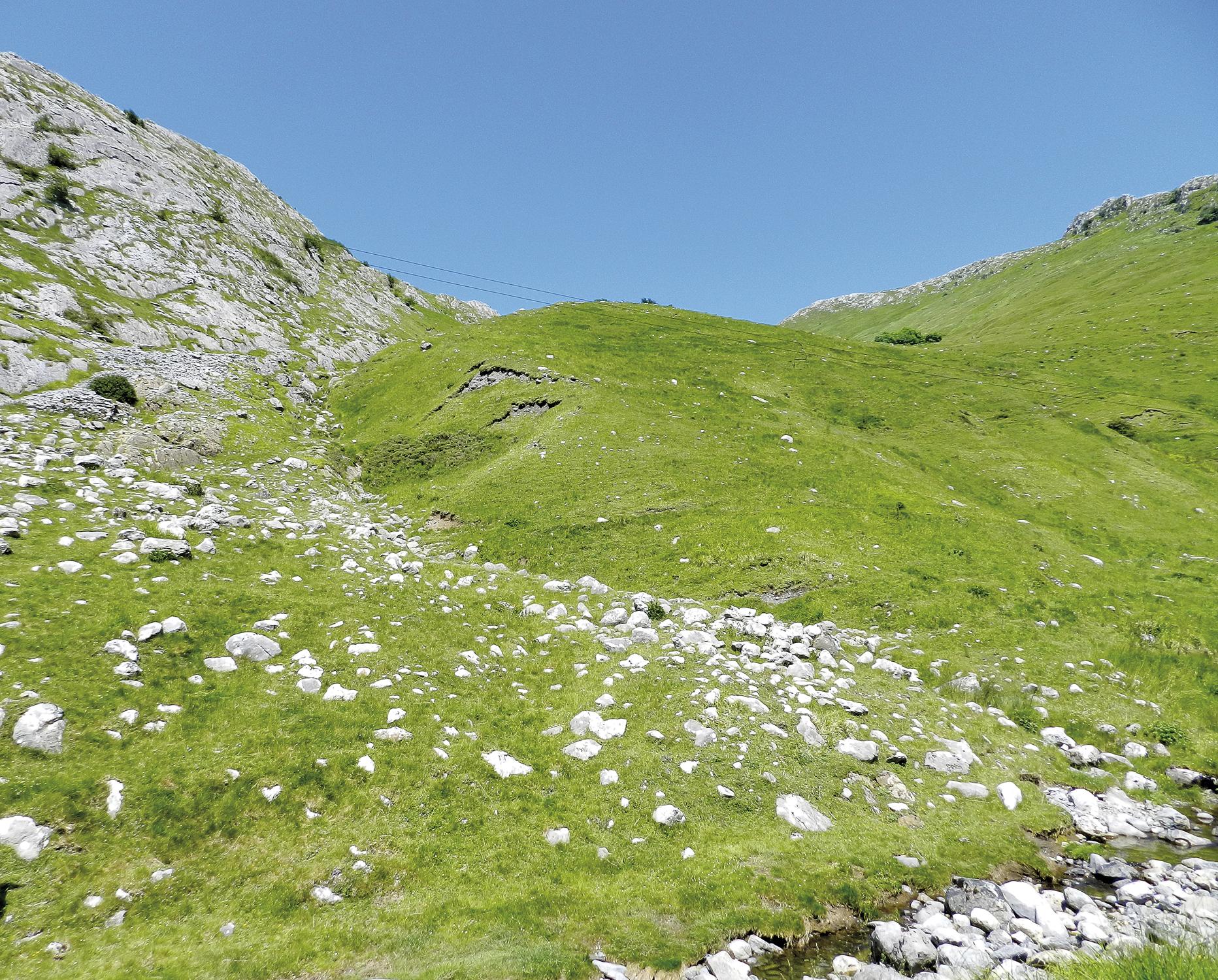
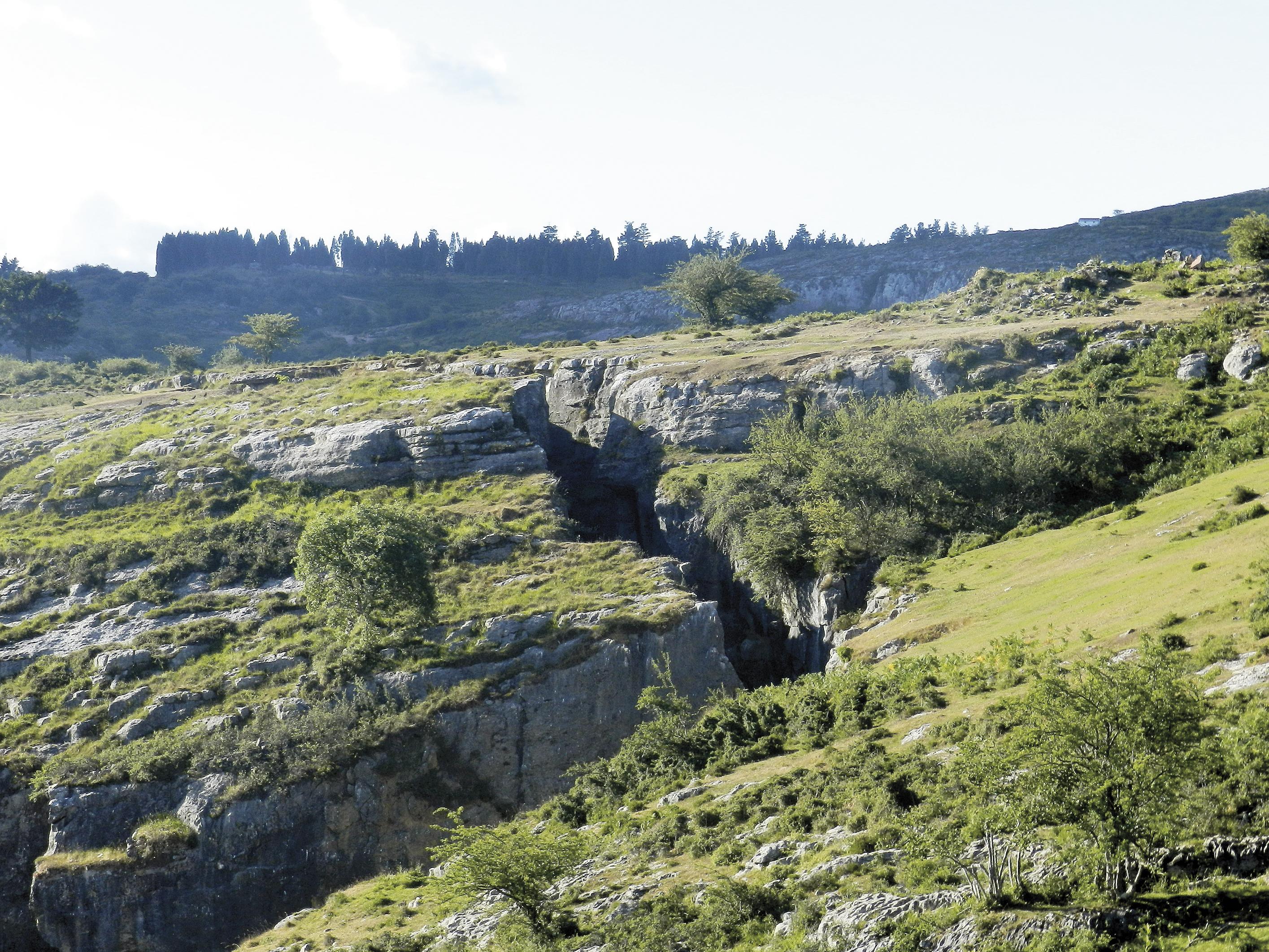
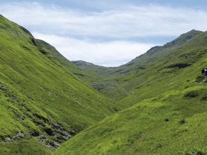
Glacier Valley of Arritzaga
Ed. Look at Mendia
It is the only valley of glacial morphology in the Autonomous Community of the Basque Country, and is the footprint of a glacier of 30,000 years ago. With a length of five kilometers and a thickness of between 70 and 100 meters, it left clear indications in the landscape.
Ed. Look at Mendia
The main glacial circles have northeast orientation and are located under the top of the Ganbo, on the western side of the valley. From this upper area, the ice pile descended towards the main glacier. In it are the eroded rocks abandoned by ice and glacial steps.
Ed. Look at Mendia
In the morphology of the valley you can see a clear transition. The upper section is U-shaped, typical of the glacial valleys, while the lower section of the valley is V-shaped, characteristic of the valleys formed by rivers. In it, the bed has excavated a deep river. The most important characteristic of the complex is the large moraine (800 m. high), located next to the miner called Buruntzunzi.
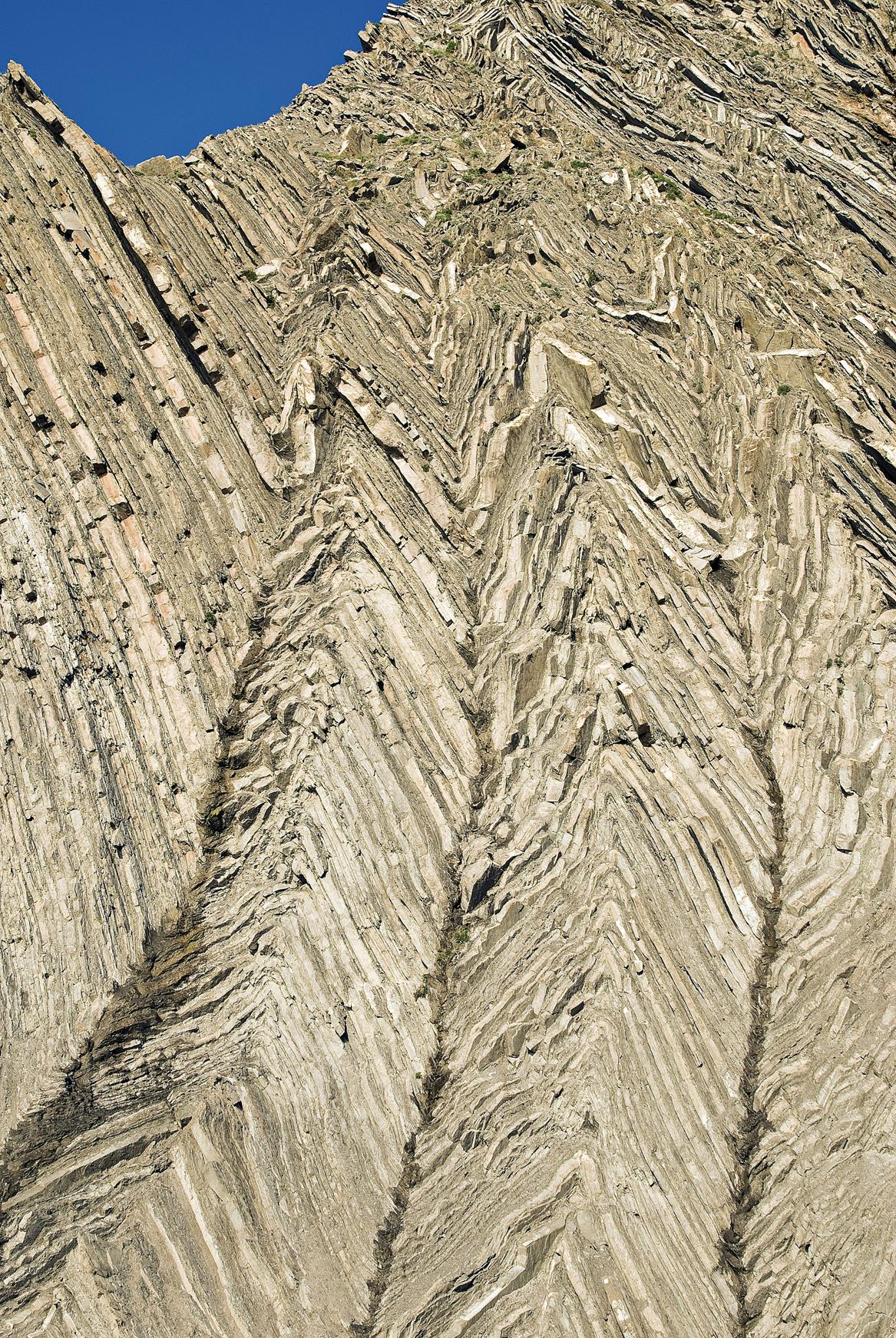
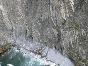
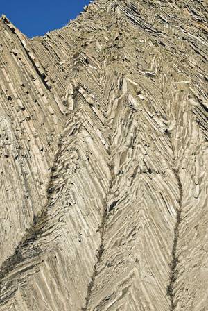
Folds of Barrika and Txitxarropa
Ed. J.C. Iturrondobeitia
At the roundabout located at kilometer 24 of the road linking the towns of Sopelana and Plentzia, on the coast of Vizcaíno, the road that leaves towards the west leads to the beach of Barrika. Those who approach him, before going out to the spectacular cliffs, should take into account the tides. The tour should be done with low tide and give for completion the tour before climbing the tide.
Ed. Ander Gómez Blanco
In these imposing walls you can see various structures: folds, cavalcades, tectonics of scales, duplex... Its rocks are formed by sandstone flysch and calcareous flysch, and in certain places volcanic rocks can be found.
Ed. Ander Gómez Blanco
In the vertical section of the cliff appear materials and structures in the vertical plane, while in the intertidal rasa these structures can be seen horizontally.

Ed. Ander Gómez Blanco
The materials of the Upper Cretaceous Cenomic and Turonic (100,000 and 93,000 years ago) are those that are folded and deformed in Barrika.
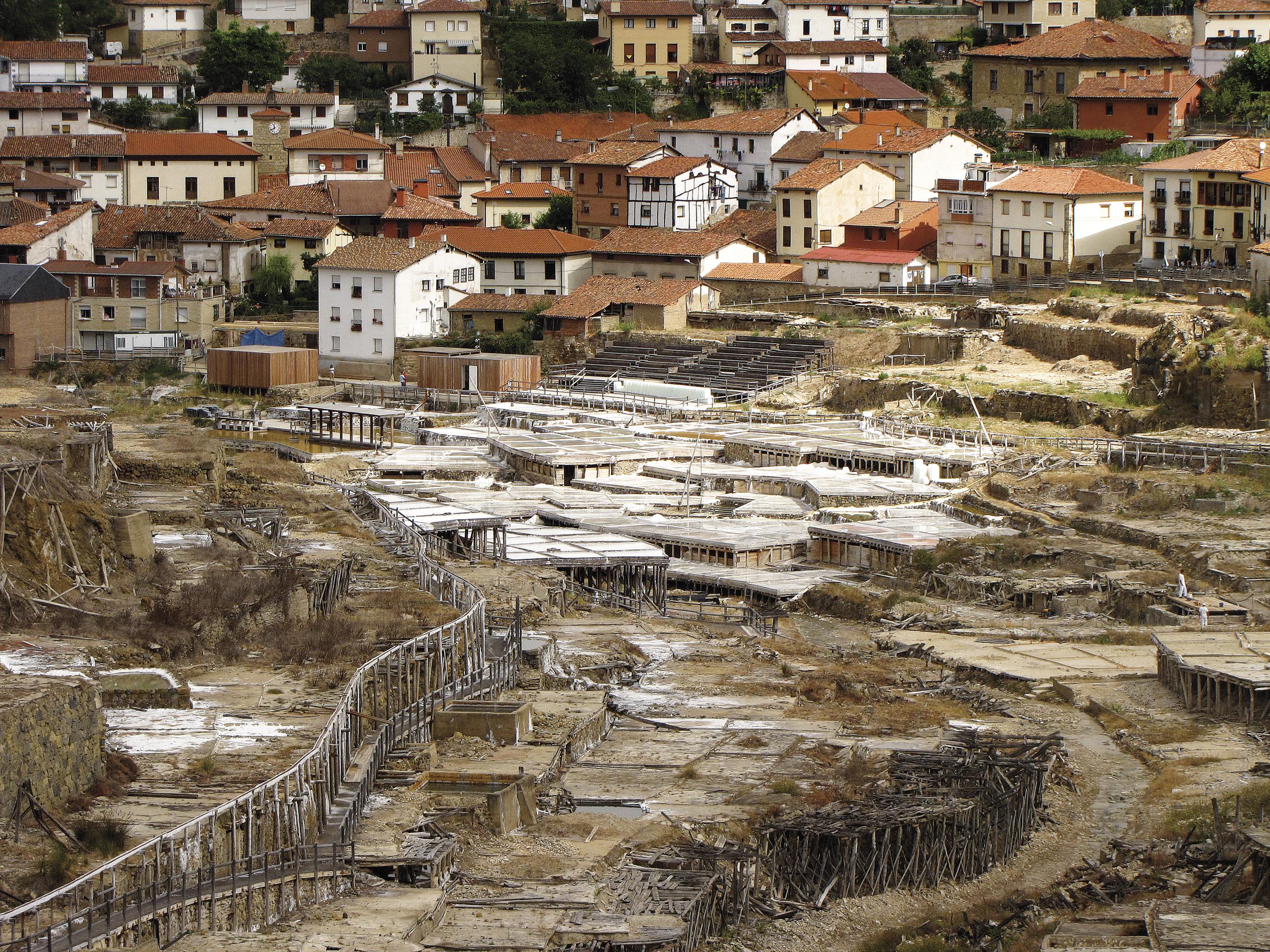
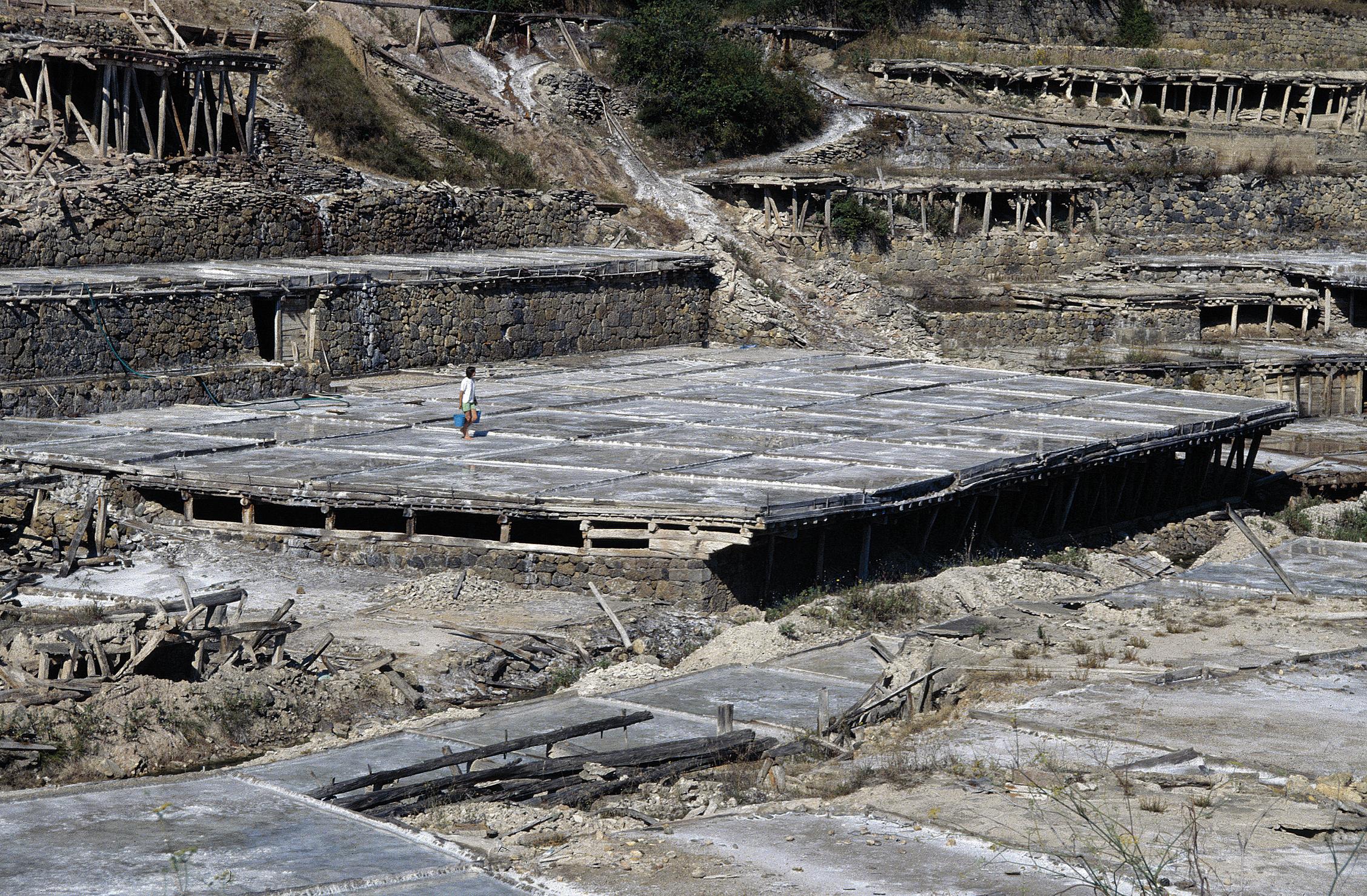
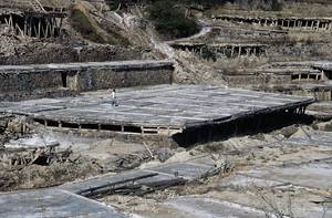
Salt Valley of Salinas de Añana
The open-air mining is the geological center that houses Salinas de Añana, but here there are no movements of machinery, sudden or similar explosions. The water, the sun and the silent work of the human being have been sufficient in Salinas de Añana to obtain salt throughout the centuries, and is the result of the geological treasure of this Alavés people.

Ed. Asier Hilario
The saline exploitation is from Roman times. The underground waters erode and decompose the saline rock, water mixed with the salt that leaves the springs. The water pressure in the ascent is high and in the spring flows by the decompression of the gases it carries. The Salinas de Añana brine has 190 grams of salt per liter and, due to its high quantity, salt crystals are formed around the source.
Ed. Mikel Arrazola/Irekia - Basque Government/CC-BY 3.0
The brine is the flow of a main source, that is, the salting of water, which through a structure of channels extends to the eras. In the gardens the water is heated and when reaching 20 degrees of temperature, the fat is stirred again and again to form the first layers of salt.
The main water distribution system has a length of three kilometers and, although currently 135 eras are used for the salt exploitation, XX. In the mid-twentieth century there were more than 5,000.
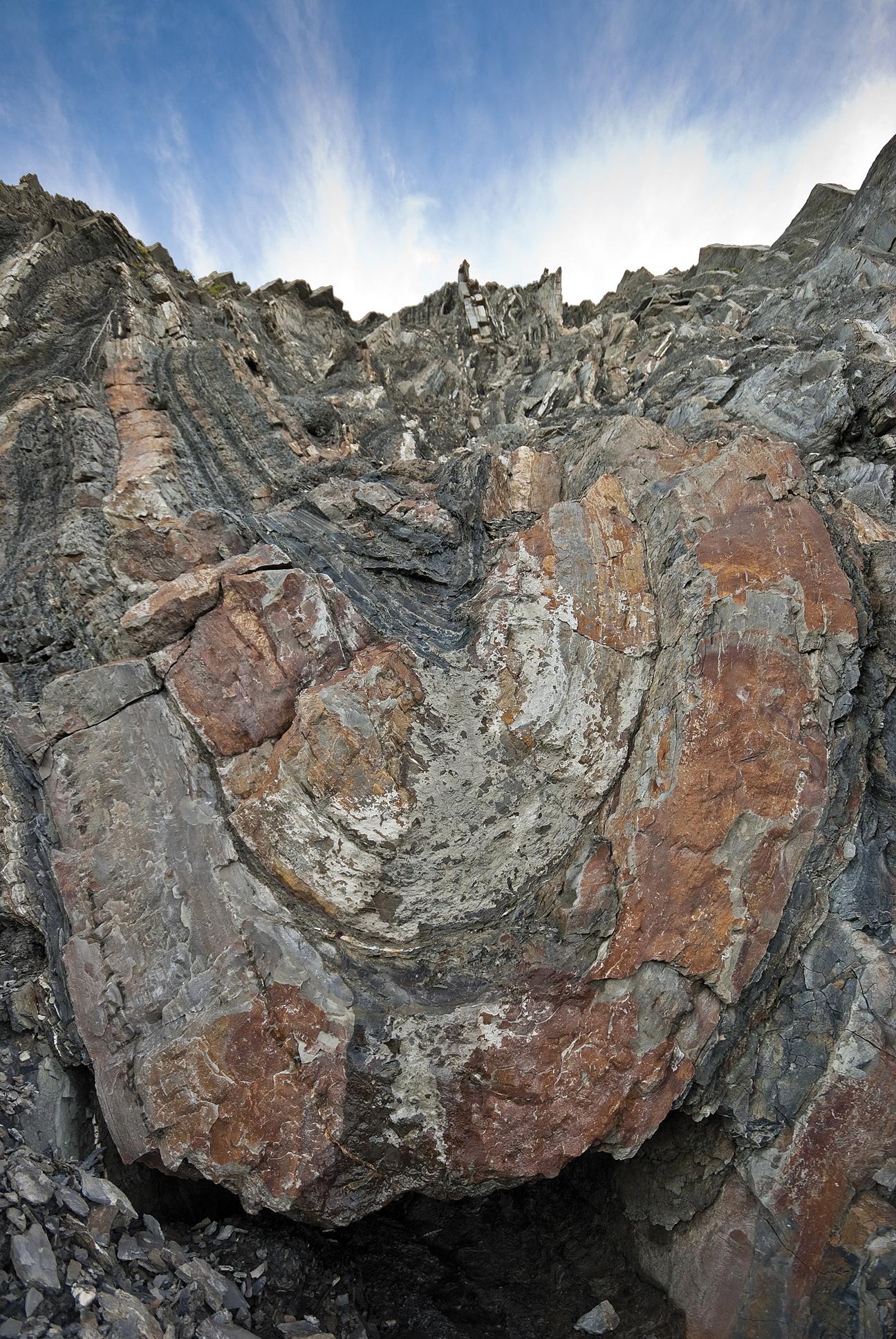
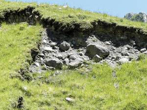
Iron filones of Laia-El Sauco
The iron deposits of Bizkaia have had a great importance throughout history and constituted the key to the industrialization of the country. XX. At the beginning of the twentieth century, 10% of the world's iron production was of Biscay origin.
Ed. Look at Mendia
In the mining area, witnesses of these farms abound. From the geological point of view, the main mineralizations of the anticlinal southwest of Bilbao come from the municipality of Galdames. We can observe the soils that present an elevation of rocks in layers. There are still the remains of exploited subvertical iron filons and the spots on the ground caused by excavations are visible in the landscape.
In addition to open pit farms, there are access galleries that follow the direction of the filones and connect with the lower levels of the mine.