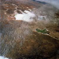
Salina de Uyuni, almost totally flat
Text created by automatic translator Elia and has not been subsequently revised by translators. Elia Elhuyar
Salina de Uyuni, almost totally flat
01/01/2008 | Elhuyar

(Photo: Recent searches
American geophysicists have measured the extent to which Uyuni saline in Bolivia is flat. The salinera is not quite flat, but it is very little, since it has a maximum ups and downs of 80 centimeters in an area of 10,500 square kilometers. However, the salinera is better than the sea to calibrate the measuring instruments of the satellites, since the surface of the sea water presents greater fluctuations. Precisely the work of the geophysicists has given the approval to the saline of Uyuni to calibrate the sensors of the satellite ICES at NASA.
1.
238
2008
1.
001
Geology
News in brief
Security


