

New seabed map
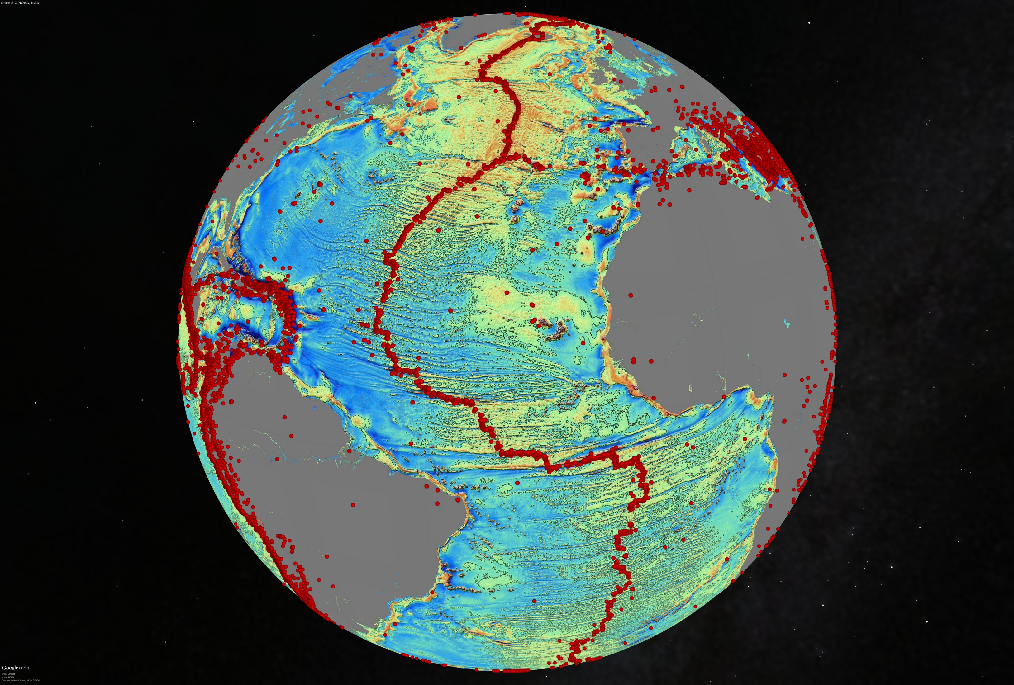
Thousands of underwater mountains and extinct volcanoes that have not yet been known have appeared on the new map of the seabed published by Science magazine. And new indications of how the continents were formed. In fact, researchers at the San Diego Scripps Oceanography Organization have used a more accurate way to create seabed maps from satellite data. The previous version of the seabed map was already 20 years old and now they have managed to double their accuracy.
The changes that occur in the gravitational field of the Earth have contributed to the formation of this high-definition image, using for this purpose two data flows that were not previously studied: ESA satellite CryoSat-2, which in principle has the mission to collect data from the ice poles, is continuously floating over the oceans, and NASA satellite Jason-1, reprogrammed in the last year to measure the gravitational field. The combination of these new data and the greater precision of current sensors has allowed drawing the deepest and most unknown parts of the oceans.
Currently, 80% of the seabed is unknown, either because it is not explored or because it is covered by a thick layer of sediments. That’s why, according to researchers at the University of California, “improving ocean depth estimates” will be the most important contribution of this new map.
Zu idazle
Zientzia aldizkaria

