

City plans are not just for tourism
Until recently, modern city plans were made with aerial photographs. But a plane took a lot and it was also very expensive. Photographs taken by satellite are currently used. Their resolution is getting better and paved buildings and terrains are easily separable.
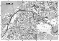
These plans, in addition to serving for tourism, are used by experts to predict how the accumulated rain on the pavement after rain storms empties. To do this they take into account the concentration of waterproof areas, that is, terrains and asphalted buildings. In fact, after rain storms an erosion can occur that can drag large amounts of land and chemicals into rivers, streams and groundwater. Therefore, it is important that from time to time new plans of the city are made, since growing and expanding constantly, the data reflected in the maps become obsolete in a very short time.
Zu idazle
Zientzia aldizkaria

