

Old Summit: Clues to the eruption
 400
400
The eruption, begun on September 19, 2021 in La Palma, has launched not only a large number of inhabitants, but also geologists of the Instituto Volcanológicas de Canarias and the Instituto Español de Geología y Minas. In the center of the geological spectacle, accompanied by drones, seismographs and satellites, lava and ash samples are being taken for precise pretrochemical studies. This clarifies the characteristics of the rash and its evolution.
Estronbic eruption
Geologists classify different types of volcanoes and eruptions, which conditions the formation of lava rivers and volcanic cones, for example. One of the most common is the Hawaiian eruption, which refers to volcanoes that take out the magma with very low strength and speed; the estronbolian, with a continuous eruption, with continuous lava and occasionally with small explosions; one of the most known is the Ubiquitous vesuplanus, the most dangerous and explosive, thanks to the large number of gases it contains. Geologists affirm that the eruption of La Palma is stronbolian, which has allowed its inhabitants to leave in time and without danger.
Magma tank
In fact, under the hard surface of the earth's crust (lithosphere), the mantle of the earth is a reservoir of magma that can come out in various ways and places. In 2017, geologists learned that the magma was coming up. At first, the magma tank was 33 kilometers away from the Earth's surface, then it was discovered that it was 10 kilometers away and soon began to climb quickly. Finally, the magmatic bed was located 2 km deep and the first seismic movements began to be noticed on 11 September as a sign of land surface rupture and magma exit. It is difficult to know where it is broken, but fortunately it has not happened in the most populous areas.
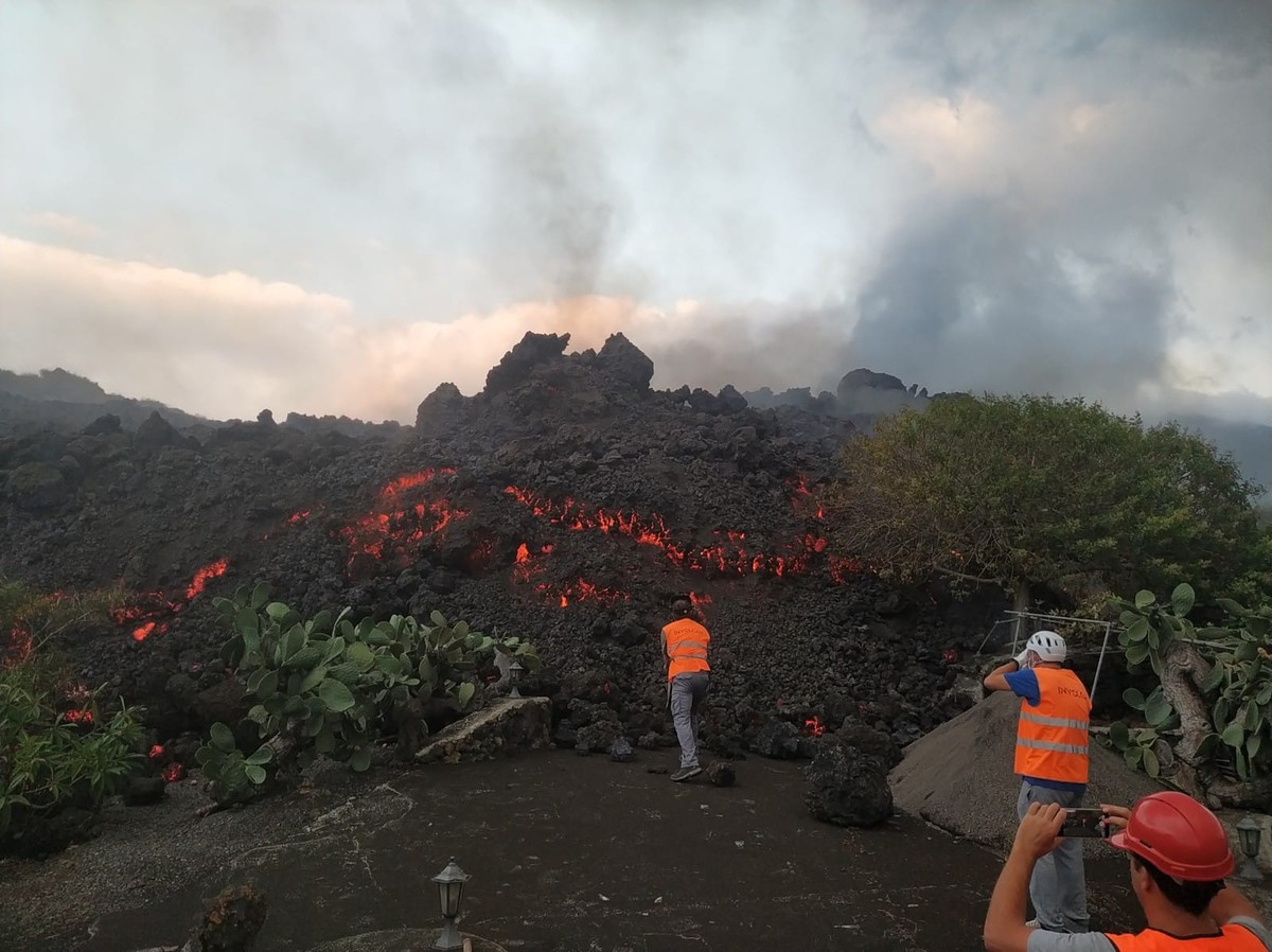
The Viejo Summit is being rash by cracks. At the moment, eight outlets have been created, but geologists believe that new ones will be created. However, not all the characteristics of the rash have yet been clarified and it is not clear what the outcome of the coming weeks will be. The evolution of Laba's path is being followed. The evolution of the speed, power and width of the casting is being studied in order to identify the need for evacuation of new areas.
Pyroclasts
On the other hand, geologists are working to clarify the volcanic intensity index. To do this, they must know the structure and volume of the erupting matter (pyroclast). Geologists distinguish three types of pyroclasts, depending on their size: ashes, which collect particles of less than 2 mm in diameter, lapillis, particles between 2 and 64 mm, and volcanic pumps over 64 mm.
Researchers are currently collecting samples of all types of pyroclasts. The chemical character and the resulting ash cloud height are being studied. And that is that the eruption has occurred in an inhabited area, so the priority has been not to cause personal harm, but actually the ashes are the greatest risk that the eruptions can generate if you look at it globally. These are fine fragments of rock of less than two millimetres in diameter that can reach long distances using atmospheric circulation. They usually have silica and can cause inflammation of the respiratory system. The presence of sulphur dioxide (SO2) may cause skin irritation.
Arrives at sea
Another concern has been the sea from the beginning, because if the lava comes there, other gases can be spread. When you have the lava above 1,000 degrees Celsius, when you hit the sea, you evaporate the chlorine, fluoride and sulfur they contain. Steam can expand these toxic gases causing respiratory conditions in the area's inhabitants. It can also cause acid rain by endangering vegetation.
Geography is changing.
Lava occupies an area of 154 ha and the surface of the island has increased by several centimeters. It will probably continue to grow and evolve. The rest of the previous rashes have lasted about two months in La Palma, but the magmas willing to come out of the holes are still being calculated to make more precise forecasts.
It does not seem that the eruption will have an explosive phase, but the release phase of the lava may be longer than desired.
Measuring instruments
The main tools that researchers are using to track the eruption are:
Drones: they are being used to follow the evolution of the path that lava is making. The evolution of the speed, power and width of the casting is being studied in order to detect the need to empty new areas.
Satellites: They explore the rise of land through iridiometry. At the moment, it is clear that it has grown almost 30 cm.
Seismographs: They informed about the initial movements and it was known that the eruption would occur in the short term. It's now helping researchers calculate the amount of magmas that are about to come out.
NOTE: The linguists of Elhuyar have published several explanations about the Basque terminology of volcanoes. Here you can see.
Zu idazle
Zientzia aldizkaria

