The underground treasures of the Dominican Republic in light
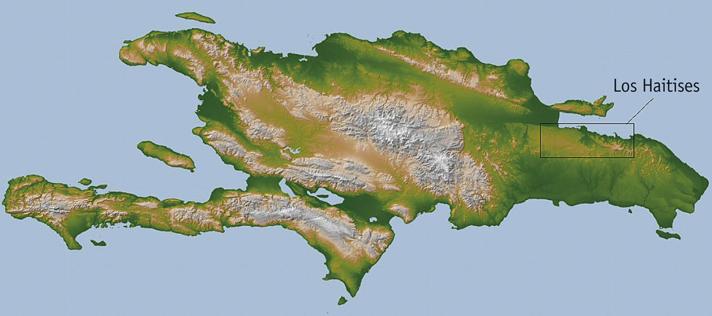
Los Haitises Park, located northeast of the island, is a carbon-protected territory of 673 km 2, part of a larger tropical karst (the German term karst means "calizo altiplano"). The karst relief is due to various chemical and physical reactions. The higher the temperature, the more humidity and the more compact the vegetation - as in tropical karst -, the more effective is the dissolution of karst.
This tropical karst has an area of 1,350 km 2 and a strong karstification caused by time and humidity have created a spectacular landscape, shaped like an egg box (cockpits); among the numerous hills (hums or haitians) there are many dolines (or holes) (Díaz de Neira and Hernaiz, 2004).
In Los Haitises Park there is no conventional network of streams in the cries. In fact, tropical karstification means the existence of numerous entrants through which rainwater penetrates and passes underground. Most of the streams are located on the outskirts of Los Haities, with radial morphology or parallel to the karst. The main rivers of the north are Yuna and Yabon. The Yuna River empties its waters to the bay of Samana and the Yabon River leaves to the sea near Sabana de la Mar.
The largest aquifer on the island of the Dominican Republic is located in the Natural Park of Los Haitises, and its water is mostly rainy, although to the west of the karst there are several streams that supply water. Due to the mixture of both types of water, the hydrogeological operation of the water circulating inside is different and very complex to investigate.
Its climate is tropical (26 degrees average), with few changes throughout the year, with annual rainfall in general abundant (between 1,800 and 2,200 mm) and frequent tropical storms and hurricanes (Secretariat of State for Natural Resources and Environment, 2006). The values of the evaporation and perspiration potential are also very high, 1,500 mm annually (Díaz de Neira and Hernaiz, 2004). Los Haitises Park is the wettest place on the island, with a very compact tropical vegetation.
Results of the water travel test
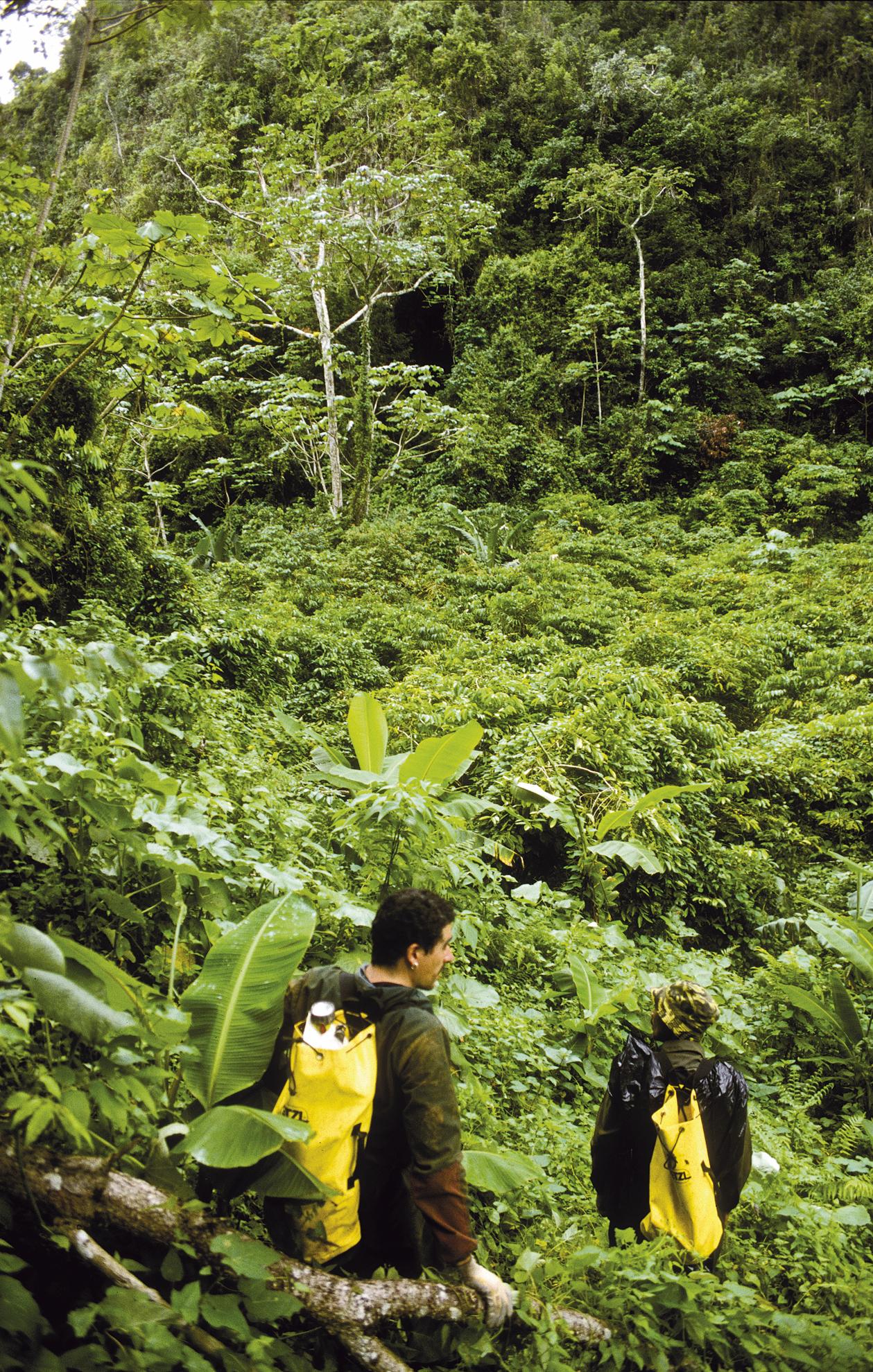
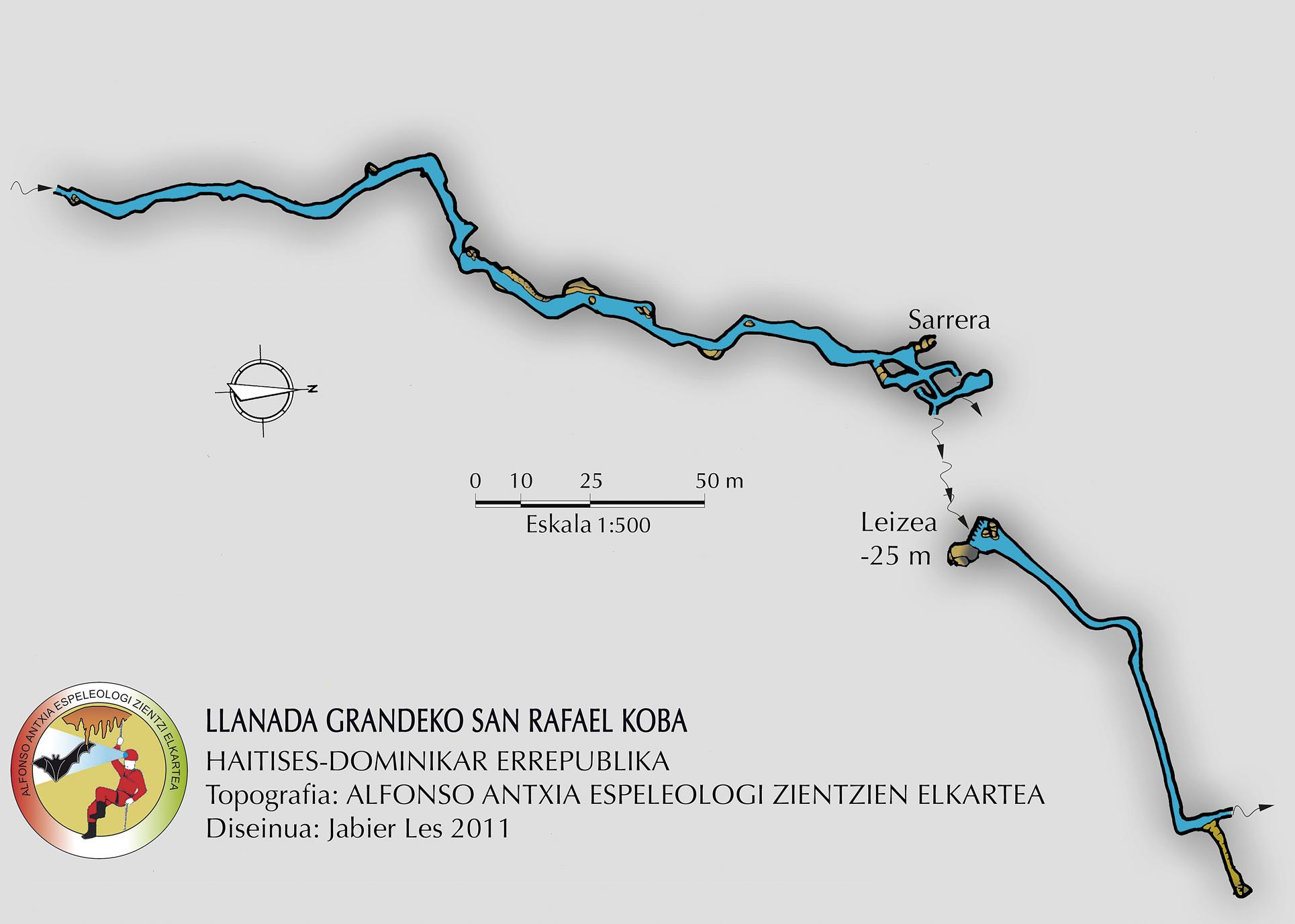
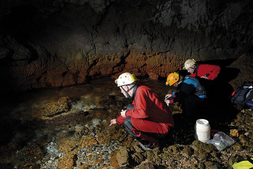
In February 2010, Alfonso Antxiano programmed a dyeing essay with the aim of investigating the water routes of the karst of Los Haities in the river that runs through Sabana de la Mar and the bay of Samaná. This water comes from the Jibale spring of Fondo Caño (in the lower part of the karst), but the route until reaching the spring of Jibal was unknown. Taking into account the guidelines of karst fractures, and according to the information of the Juan guard, the origin of the water could be in the cave of San Rafael de Llanada Granda, in the park of Los Haitises.
To find out if this was the case, in the cave of San Rafael we cast the dye (uranine, that is, the sodium fluorescent) and in the streams and springs where the green dyed water could be extracted, fluorocaptants were placed. They are bolsitas with active carbon that are introduced in the water and after analyzing them we can know if the water with dye has passed through that place.
Thus, on February 11, fluorocaptants were placed in the lower springs and streams of the karst, and on February 12, at 10:15 in the morning, a kilo of uranine was deposited in the cave of San Rafael.
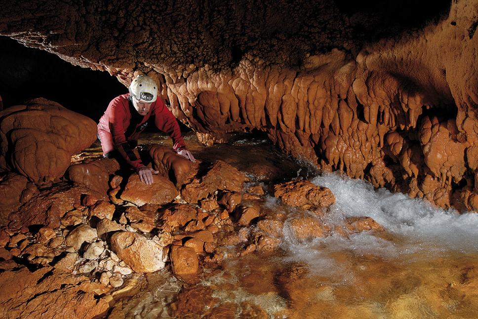
Two days after the application of the dye, the dyed made by the group showed that the origin of the water was in the cave of San Rafael, in the Llanada Grande of the park of Los Haitises, since the dye appeared in the nacedero of Jibale. In the following hours, the wells of Caño Hondo, the river that leads to Sabana de la Marrera and the bay of Samaná appear dyed green.
Thus, Antxiaco checked, on the one hand, the origin of the water and, on the other, that the water that penetrated inside the karst did not last long. Furthermore, we found that in two days it reached the lower springs of the karst. In addition, taking samples of Caño Hondon every hour, we were able to measure the output speed of the dye.
In the concentration curve it is observed that the main peak appears at 60 hours and at 80 is a second. This distribution is typical of karst aquifers with light flow. These two summits can also indicate that the flow of water runs through two main roads, that is, there can be a main road, lighter and very broad, and a second, more complex and narrow. The latter is probably the reason why the dye appears later. In summary, the traffic flow is very light (the maximum speed measured was 1,100 m/day), taking into account also that it was not rainy season, which confirms that it is a place with a high degree of casrtification, since, as has been said, tropical karst usually present a very high level of dissolution.
On the other hand, the dye only appeared in the higher altitude spring (Jibale) and not in other observed springs (at lower altitudes), because the water layer that moves in the aquifer is very fine and we can conclude that it runs very superficially to the bay of Samaná and reach the sea.
Physic-chemical, isotope, and microbiological analysis of aquifer water
For the realization of physical-chemical studies, field equipment was used. Microbiological studies are carried out with a hand heater and laminocultures (special plates for the growth of microorganisms).
In general, the karst waters of Los Haities are low or medium mineralization waters with neutral pH and good quality in terms of physicochemical parameters (sodium, magnesium, chloride, bicarbonate and nitrate).
Microbiologically, this is water that requires a simple treatment for its potabilization, that is, filtration more disinfection. (RD 927/1988, 29 July and subsequent modifications).
On the other hand, isotope studies of the waters of karst were conducted. Stable isotope studies were conducted at the CSIC in Granada (Consejo Superior de Investigaciones Científicas). In these studies, the amounts of stable isotopes of oxygen, hydrogen and carbon from water samples (i.e., ?2H, ?18O and ?13C) and their relationships were studied.
According to the relationships between the isotopes of hydrogen and oxygen of the water (?2H and ?18O), we have been able to know quite reliably some data on the water of the aquifer: if it is rainwater or if it is water that accumulates in the subsoil; in what height is filtered, especially, the rainwater; and what is the relation between this type of rainwater and accumulated water). In other words, analyzing the number and percentage of isotopes of water in a given place, we can learn about precipitation, altitudes and other typical characteristics of the place.

And studying the isotope concentration, we have been able to know the degree of evaporation of water.
On the other hand, the study of the carbon isotopes (?13C) of the water allows to know the origin of the carbon, that is, if the carbon comes from the dissolution of the limestone or if the water has been extracted from the earth in its path.
The results obtained after the investigation of the isotopes of ?13C have shown, on the one hand, the importance of vegetation in the origin of the carbon of the waters. On the other hand, at present the formation of structures is more important than the dissolution, that is, the structures type stalagmita and stalactite are being formed constantly thanks to the local conditions. Finally, most of the water from the aquifer comes from the rainwater, so the characteristics of the water vary widely from dry to wet form.
In addition, to investigate the climate of recent years in Los Haities, we took a few stalagmites to study their isotopes. The study of isotopes allows us to know the characteristics and origin of the waters that formed the structures, as well as the periods of drought or rain that occurred during their formation, that is, the climate of the last thousands of years. These investigations are taking place in the CSIC of Granada and will end within a year.
Conclusions of the conclusions: Conclusions
The debate about the industrial exploitation/non-exploitation of the park of Los Haitises, with some vicissitudes, is long ago and we must say that the debate is now more passionate than ever. Since a U.S. multinational company expressed its intention to install a cement factory, the debate between supporters and opponents has been constant. The owners of the factory and the supporters of the facility mention the economic benefits. But there are unquestionable reasons which clearly indicate that the factory installation would have negative consequences.
The data obtained proved that the quality of the waters of the park of Los Haitises was good, both from a physical-chemical and microbiological point of view. However, in case of contamination, this would pose a risk of contamination of aquifer waters due to the permeability of karst. That was our first conclusion.
Second, we saw that the waters that circulated through the interior of the park appeared in the bay of Samaná and in the Sabana de la Mar in two days, so we realized that their speed of circulation was very low. This indicates that a small pollution caused by an industrial activity in the park of Los Haitises would directly affect the diversity of the bay of Samaná and the irrigated areas of large areas of Sabana de la Mar (we speak of an ecological catastrophe: fish, endemic herons, pelicans...); and the areas of drinking water and drinking water (we aggravate).
Third, changes would occur in the aquifer that could modify the conditions of formation of the structures of the caves (stalactites, stalagmites, geodes...). And the process of disappearance of the structures already constituted would intensify (it took thousands of years to be constituted).
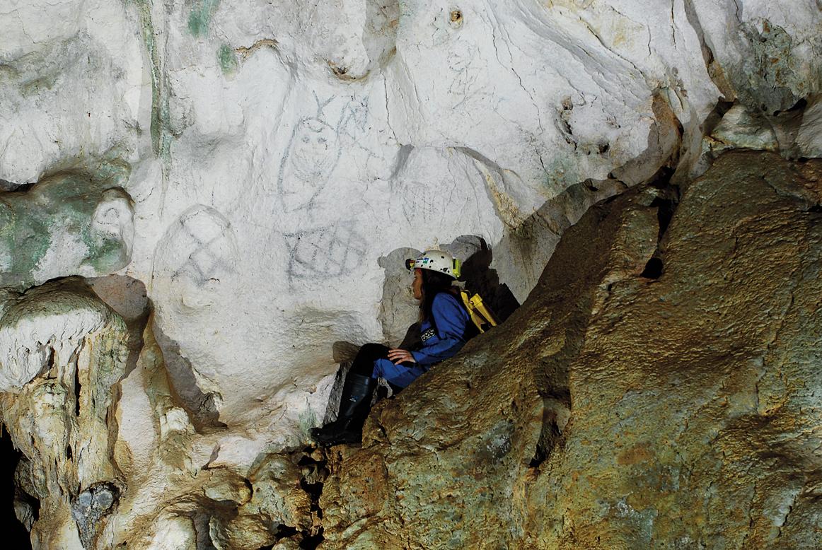
It should also be taken into account the pictographs and the Taino footprints that exist in the caves (most of them still unstudied), so if the caves are destroyed, they would disappear and the history and culture of the island's ancestors would be lost.
Finally, the installation of a factory in this harmless place would mean a brutal deforestation of the jungle, among other things because a new road network would have to be built. Another serious problem would be the disappearance of cave structures. The importance of vegetation was confirmed in the origin of the carbon of the waters. This carbon participates in the formation of the structures of the caves, so the protection of the forest is fundamental.
Therefore, our main conclusion was the need to preserve, undoubtedly, the park of Los Haitises, seeking alternatives to industrial exploitation. We believe that we must make every effort to protect this intact space from industrial exploitation, since pollution is an irreversible process.
In addition, the industrial exploitation of the park of Los Haitises does not have the approval of society, which should also be taken into account.
These conclusions were presented at the press conference offered at the University of Santo Domingo, February 20, 2010. The title of the press conference was as follows: "The investigations carried out in Los Haities have alerted the situation of vulnerability of its waters and the bay of Samaná." In the coming days our press conference came out in the main newspapers of the Dominican Republic.
MENTIONS MENTIONS
We would like to thank the collaboration of the owners of the Hotel Caño Hondo, Toni and Rosana, as well as the hotel workers for the treatment received; the caving team of Espeleogrupo Santo Domingo and, of course, all the members of the expedition: Antonio, Lorena (for us "Lore Pitonisa"), Txunai, Jabi, Josu, Marian, Rober and Nerea. Thanks to all of them, because we achieve the most important result that any expedition would like to get, have a great time and laugh.
Linguistic advisor: Agurtzane Urrutia.
OFFER OFFER
Iñaki,
"You have to take life with desire," he told me.
"I am not, do not cry, life is rare."
But hours go too slow for anyone who wants to forget,
your advice, your hot words.
I know that thanks to you I am standing.
(Ruper Ordorika)
Asier,
The rage I feel before the official lie. Intense hatred for those who cover oppression,
What I feel, the need to express it.
(Bad News)
Asier died on December 1, 2008, in a work accident that occurred in the Southern Variant of Bilbao (Supersur), due to the failure to comply with safety measures at work, as resolved on Bilbao's 9th. Judgment nº 131 of the Social Court of 18 March 2011: asierirazabal.wordpress.com.
BIBLIOGRAPHY BIBLIOGRAPHY
Zu idazle
Zientzia aldizkaria